This was the view out our hotel window this morning, just before 9 AM, as the sun came over the mountains. I was not thrilled to see ice on all of the cars.

Thankfully, the rental car came with an ice scraper.
Our first stop was just down the road in "the village", which is really just a strip mall containing the only businesses in Lake Louise that are not a hotel or gas station. We'd had scones for first breakfast back at the hotel, and added some egg sandwiches on bagels from the Trailhead Cafe.

While we waited, I ducked into the bike rental store to confirm some details for our afternoon activity. We had rented e-bikes for the whole day, but it was barely above freezing at 9:30 AM so nobody wanted to go for a speedy bike ride yet.
Instead, we hopped in the car and headed north for one exit, to the Icefields Parkway. The parkway is 140+ miles long, connecting Lake Louise to Jasper (of recent wildfire fame).
Here you can see one of the famous wildlife crossings on Highway 1.
There was another mini Park Pass toll booth to enter the Icefields Parkway, but we were waived through once the attendant saw the pass taped to our windshield already.

Our first stop was at the Hector Lake viewpoint, which was little more than a wide spot in the road. The lake was barely visible from the viewpoint, though.


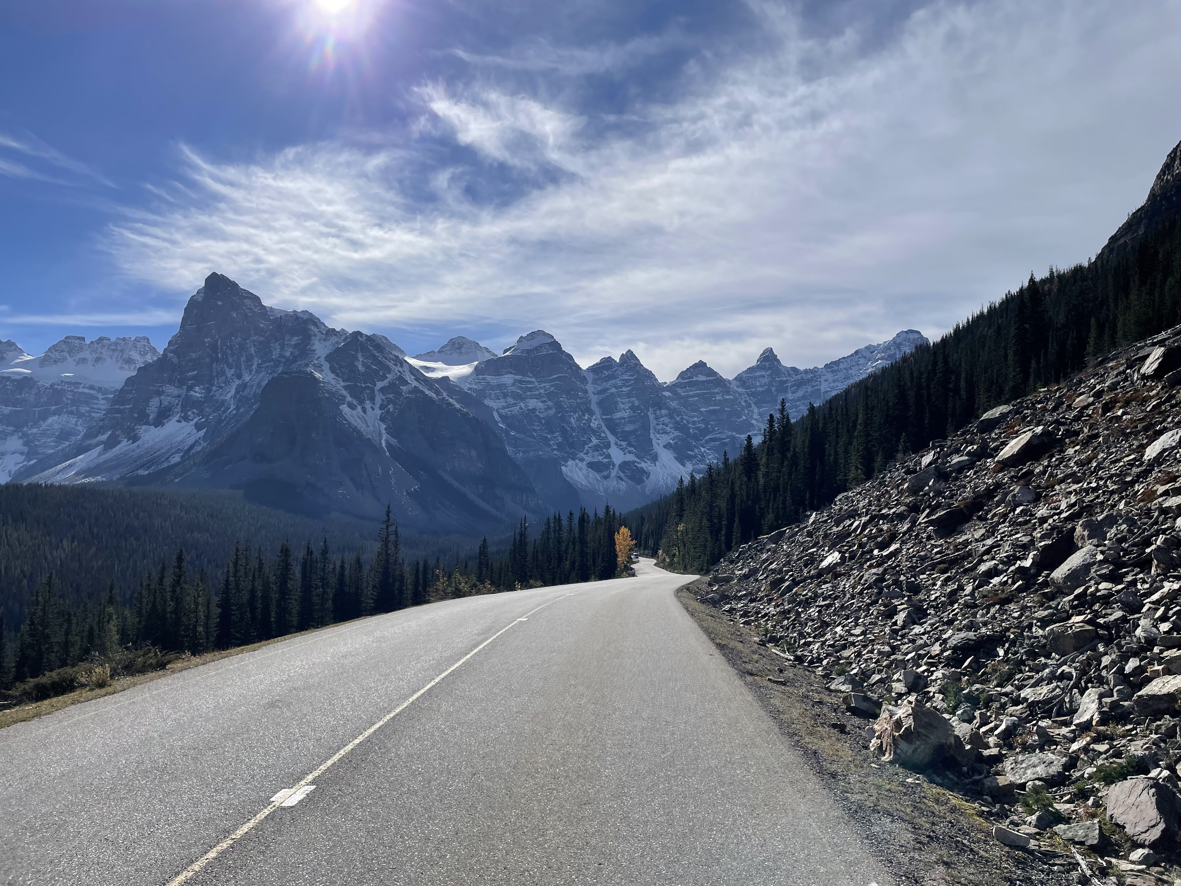
It was almost unnecessary to stop at any viewpoints, as the views were spectacular just driving along the parkway.

Our next stop was the Crowfoot Glacier viewpoint; there isn't much of it left, but it's still neat to see.
About one mile up the road, we pulled over at the Bow Lake viewpoint. I think this was our favorite stop that we made on the parkway (admittedly we only saw about 20% of it).


The little red building across the lake is The Lodge at Bow Lake, where they are currently running a special deal: book two nights or more for only $725/night for two people.


About four miles up the parkway from there, we turned onto the access road to Peyto Lake.

From the parking lot, it's about a half-mile walk through the woods, on a paved trail, to the viewing platform above the lake. It was 11 AM when we started the "stroll", as the guidebook calls it.

Evidence of a recent snowfall was everywhere in the shadows of the pine trees.

From the viewing platform, one can see where the Peyto Glacier used to be, along with the small bit of it that remains, up by the mountain peak.

The platform was fairly crowded, so it took some effort to get a photo that makes it look like we were the only people visiting today.

They even have a neat viewing... sign... tool? so you can see where the glacier used to be.

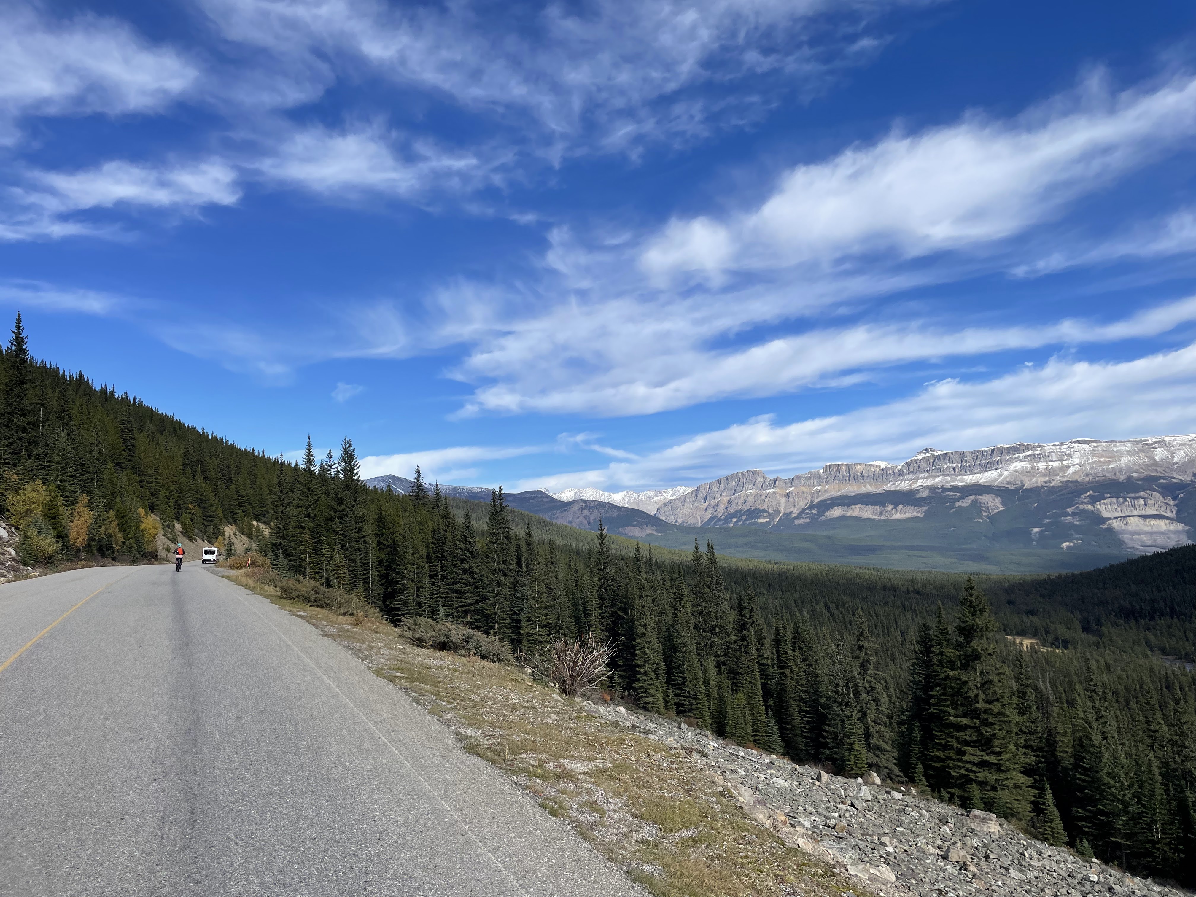
The walk back down to the parking lot had some splendid views. Everywhere you look here, there are amazing views.

Peyto Lake was the extent of our Icefields Parkway tour. There are more than 100 additional miles to explore, next time.
The views on the return ride were just as good, but difficult to photograph due to the sun being in our faces. This is the clump of peaks behind Bow Lake, I think.

Back in town, we made a pit stop at the hotel to load up on afternoon snacks, then went back to The Village to get our rental bikes. It had warmed up to 50F, so we felt it was okay to do some biking.
It was around 12:30 PM when we began our afternoon adventure.

The plan was to visit Lake Louise (the lake) and Moraine Lake via e-bike. While a bit expensive, it avoided the complicated process of pre-booking shuttle rides to one or the other and then navigating the "connector" between them. Alternatively, we could have driven to Lake Louise and paid $36.75 CAD, but the road to Moraine Lake is closed to cars.
We also planned to do some hiking at one or both, which meant we had to ride in hiking boots and bring our hiking poles in backpacks (along with food, water, hats, extra layers, etc.).
From the bike rental place to Moraine Lake was about nine miles and 1300' of elevation (thus the pedal-assist e-bikes), and we opted to go there first.

Sabrina's power-to-weight ratio was significantly higher, so she zipped up the steep hill at the start of the ride.

The first mile or so was busy with cars and shuttle buses, but after we turned onto the controlled-access route to Moraine Lake, we had the road mostly to ourselves, other than the occasional bus going up or down.


As we rode up into the valley, it got colder and colder.

The views also got better and better.


We stopped a few times to adjust seat heights, add or remove layers, change gloves, etc.


Sabrina usually passed me on the uphill portions, but she doesn't like going "too fast" on the downhills, so we kept leapfrogging. I was happy to hit 35mph before my face got too cold and my eyes started watering.

It took us a solid hour to get up to the lake, which was crowded and noisy.


We walked along the shore for a bit, but the view didn't look quite right from the water's edge.


It's apparently possible to rent canoes in the summer, but I think they stopped at the end of September.

There's a very rough trail to the Consolation Lakes that recommends a minimum of four people go together, which is concerning. Judging from the sign, at some point in the season it becomes illegal to go without a group?

Our objective was the Rockpile Trail, so named because it simply climbs to the top of the rock pile at the northern tip of the lake.

The footwear choice du jour was definitely "white sneakers", which would not have been my first choice for a muddy sojourn in Alberta.

The view from the top of the rock pile was more like what we were expecting.


On a day where we saw all manner of strange tourist examples, this might be the best eyebrow-raiser.

We found a spot to sit and have a snack lunch with a view, on top of the rock pile. Not pictured, behind me, were about 40 people all taking the same photos for Instagram.


From Moraine Lake, it was another nine miles back down the valley and over to Lake Louise.
It got noticeably warmer as we descended rapidly, racing the buses downhill. Once we turned onto the road to Lake Louise, we had to negotiate a line of traffic trying to get in. We were able to ride uphill past the line of waiting cars, thanks to the pedal-assist motor.
By the time we found the bike racks and dismounted, it was just after 3 PM. We had to get the bikes back by 5:30, so this gave us about two hours to spend at this lake.


Moraine had a lodge, but Louise has a chateau. Wikipedia suggests is has over 500 rooms, at least some of which are available for only $500/night. This is just one wing of it, I guess.

Some people take their social media content very seriously. I can't abide vertical photos of horizontal landscapes, though.

Unlike Moraine, canoes are available at Lake Louise until October 20th (this year, anyway). I just looked at the prices, and suddenly feel better about paying for the tourist trap gondola. Yikes.


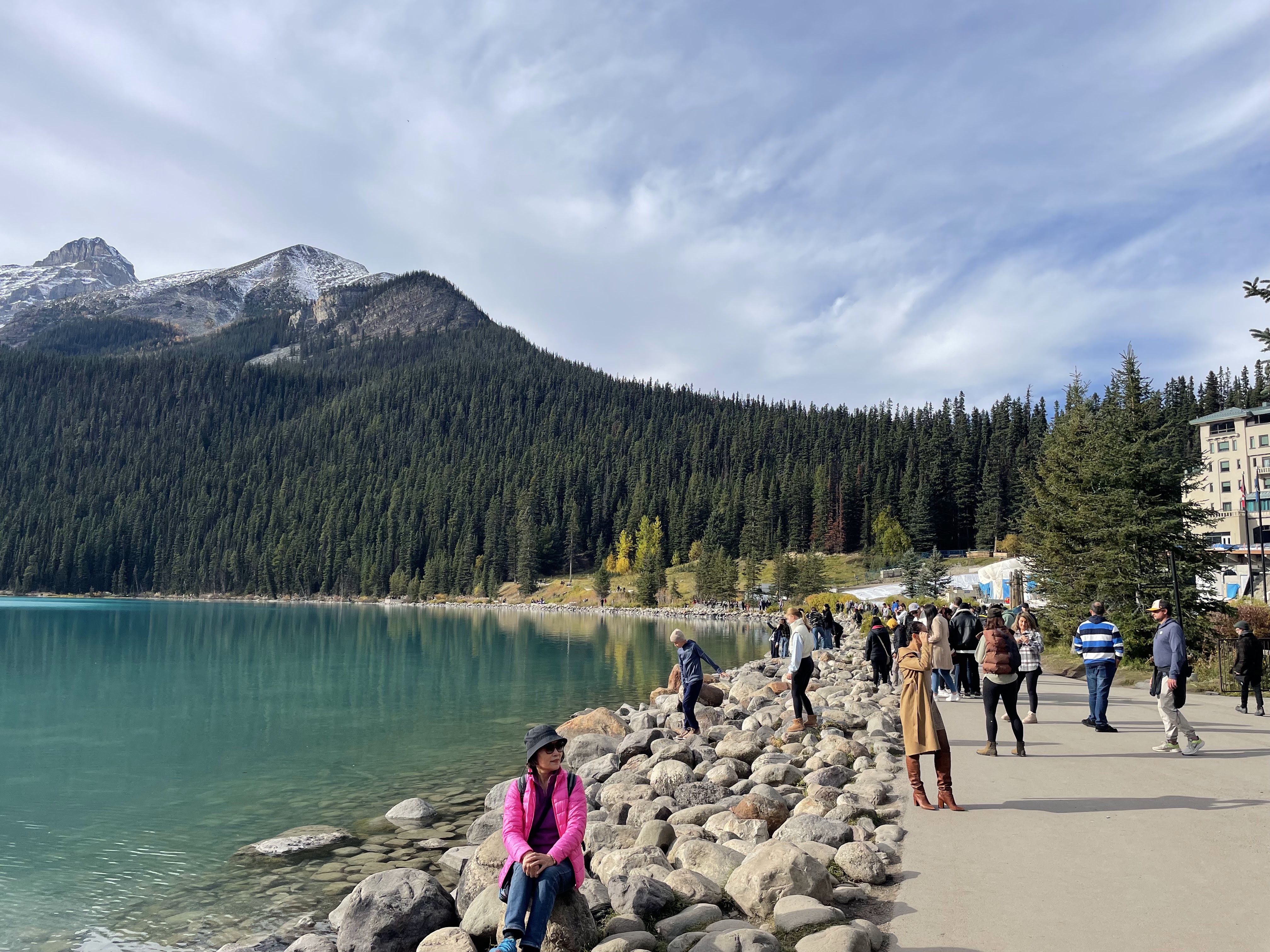
As usual, and just like everyone else, I try to get the glamor shots without random strangers in them. Here's a behind-the-scenes look at what one of the most popular spots in Alberta.

Here's the full scale of the chateau. I had to use the wide lens to get it all in frame (thus, the fisheye).

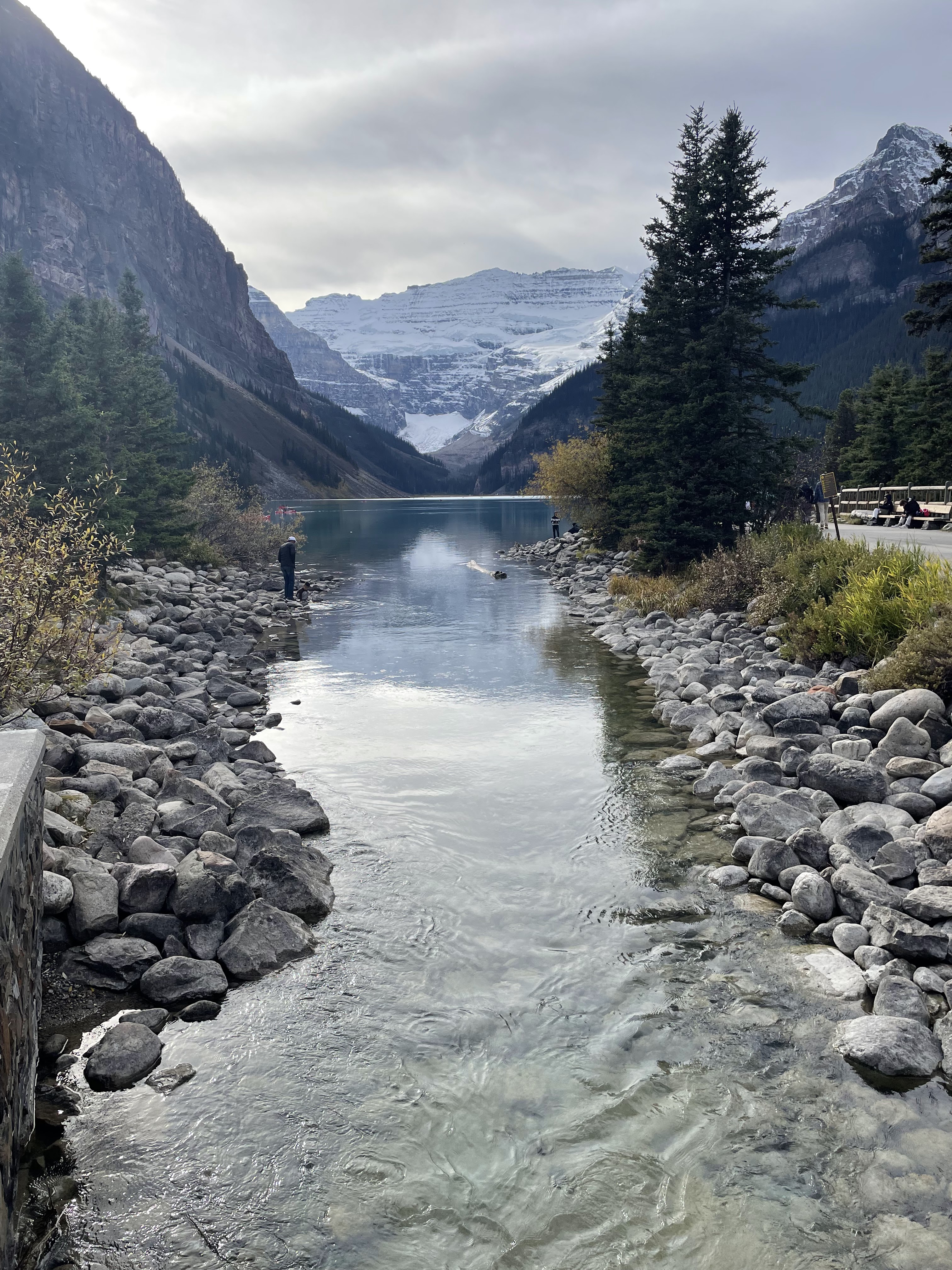
The sad part about the people who can't be bothered to walk more than a few hundred yards from the parking lot is that they're not even capturing the brilliant color that made the location famous. As seen in the photos above, with the sun at the back of the lake, the water appears sort of a translucent, dark teal.
But as you round the corner and walk up the side of the lake, it changes dramatically.


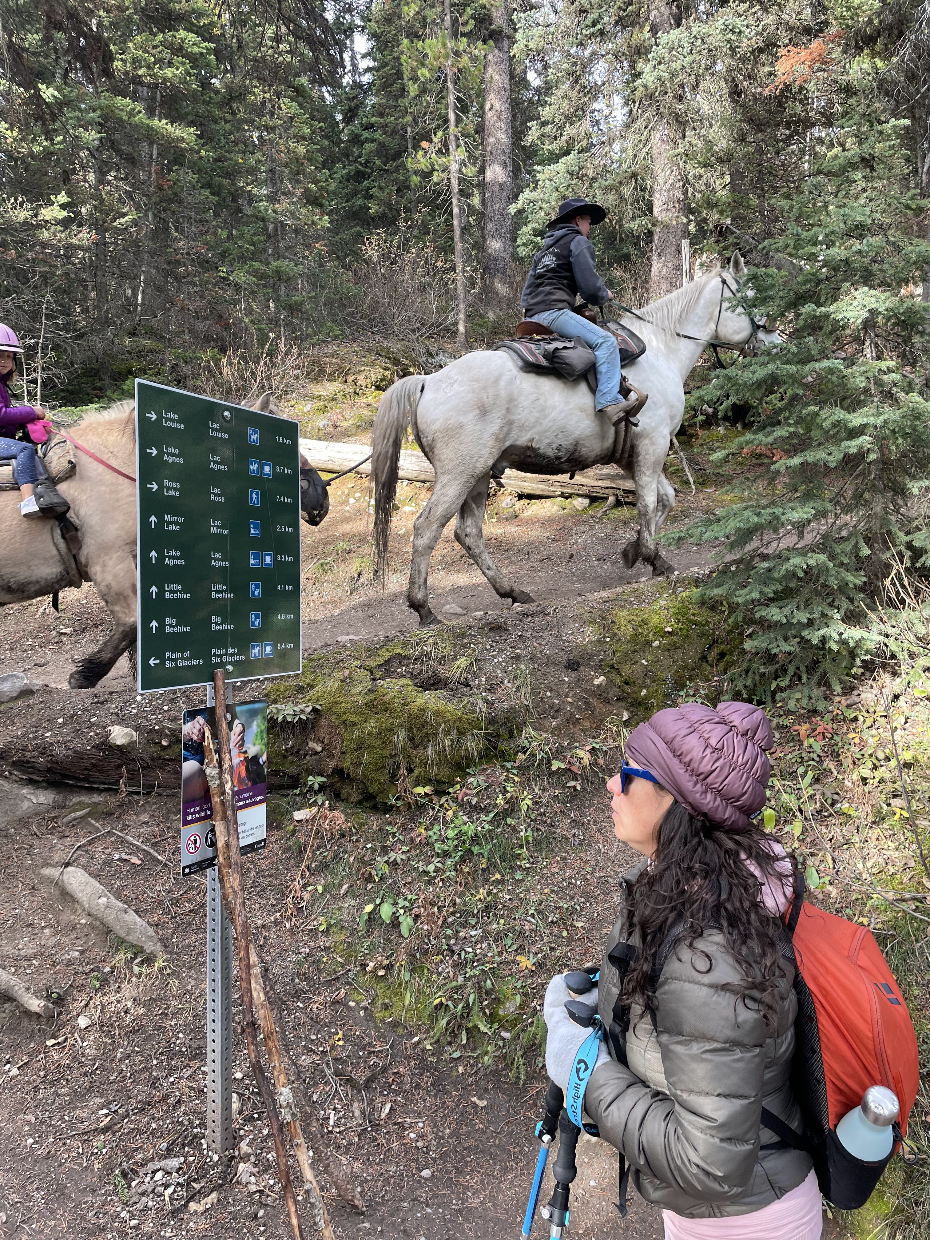
We were hoping to get a better view, from higher up, so began the hike up the Lake Agnes trail. Almost immediately, we encountered a traffic jam at the intersection with the horse trail. If I'd known that was an option, I would've offered to meet Sabrina at the top and ride up on a horse instead of hiking up the 1400 feet or whatever it was.


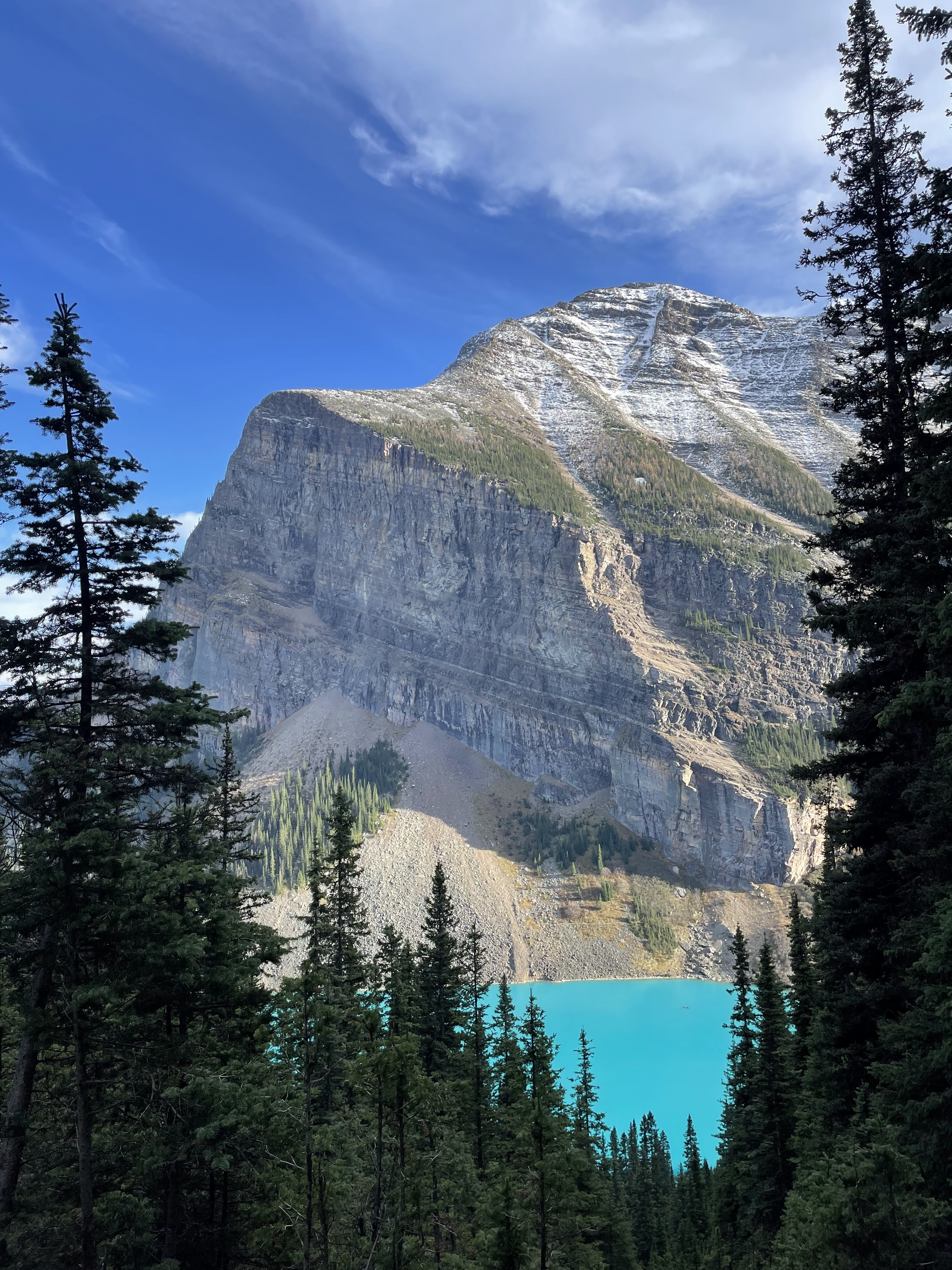
Most of the way up, we only caught slivers of the brilliant turquoise water through the trees. But there was one spot where we could see enough of it to make it worth a photo.

We didn't actually have time to get all the way to Lake Agnes (where there is allegedly a tea house), so instead stopped once we reached Mirror Lake, which wasn't much of a mirror because it was frozen and full of ice chunks.

Somewhat disappointed in the meager Lake Louise views, we trudged back down the mile and a half of trail, made haste to the bike rack, and raced back down the mountain to get the bikes back in time. It was only about three miles, so it went by quickly; we did get stuck in traffic on the way back down, but got the bikes back to the rental shop with five minutes to spare.
This was important, not just because they had set a deadline and closed at 6, but we also had a 5:30 dinner reservation just down the road at The Station Restaurant.

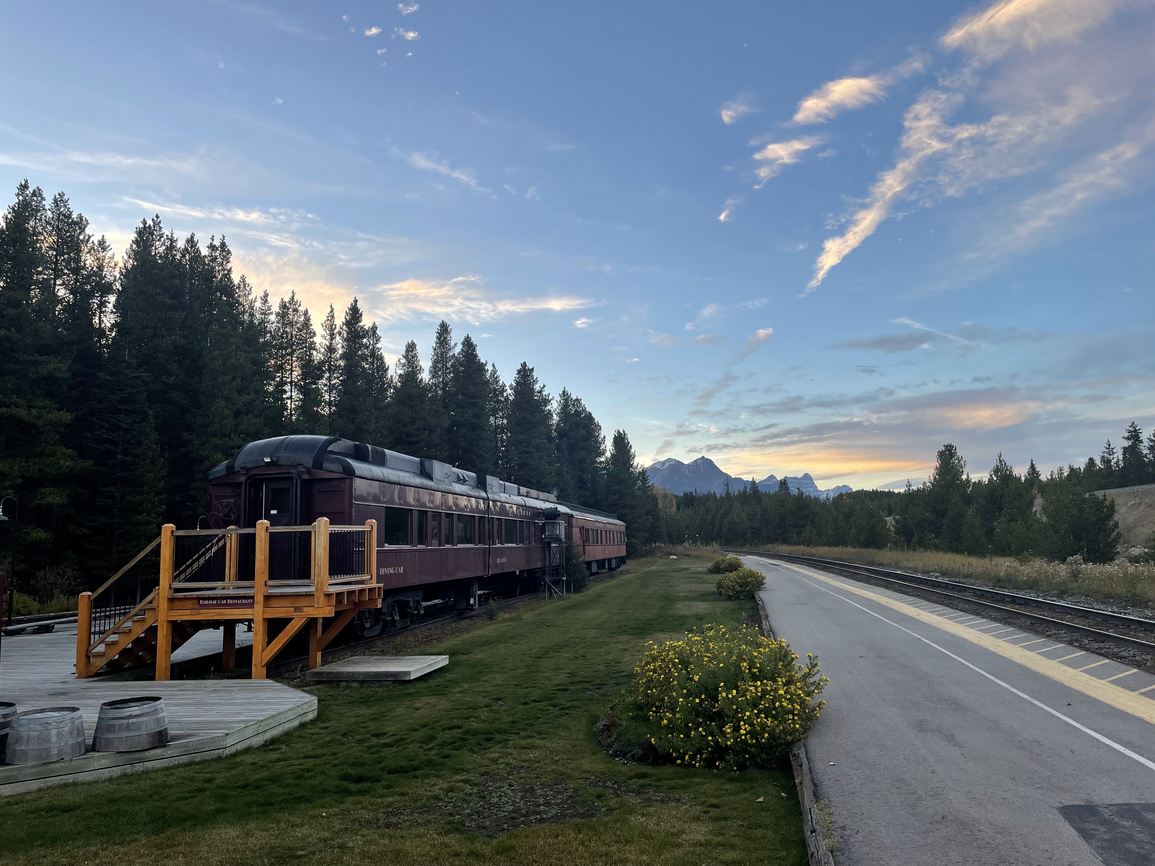
As the name suggests, the building was originally a train station.

I don't think we'd even looked at the menu, or knew much about it except that Google Maps classifies it as a "Canadian restaurant" and that it looked nicer than the hotel dining options in the area.

After dinner, we returned to the hotel for drinks, dessert, and some time in the hot tub.
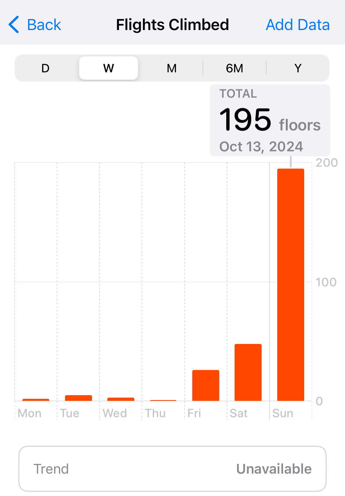
I wish that the iPhone health-tracking tech could figure out when you're riding a bike; it might not be so wildly inaccurate. Then again, we did quite a bit of climbing on foot today, so who am I to criticize?
We've seen everything that we're interested in seeing in the Lake Louise area, so tomorrow we plan to go see some of an adjacent national park just over the border (and continental divide) in British Columbia.
No comments:
Post a Comment