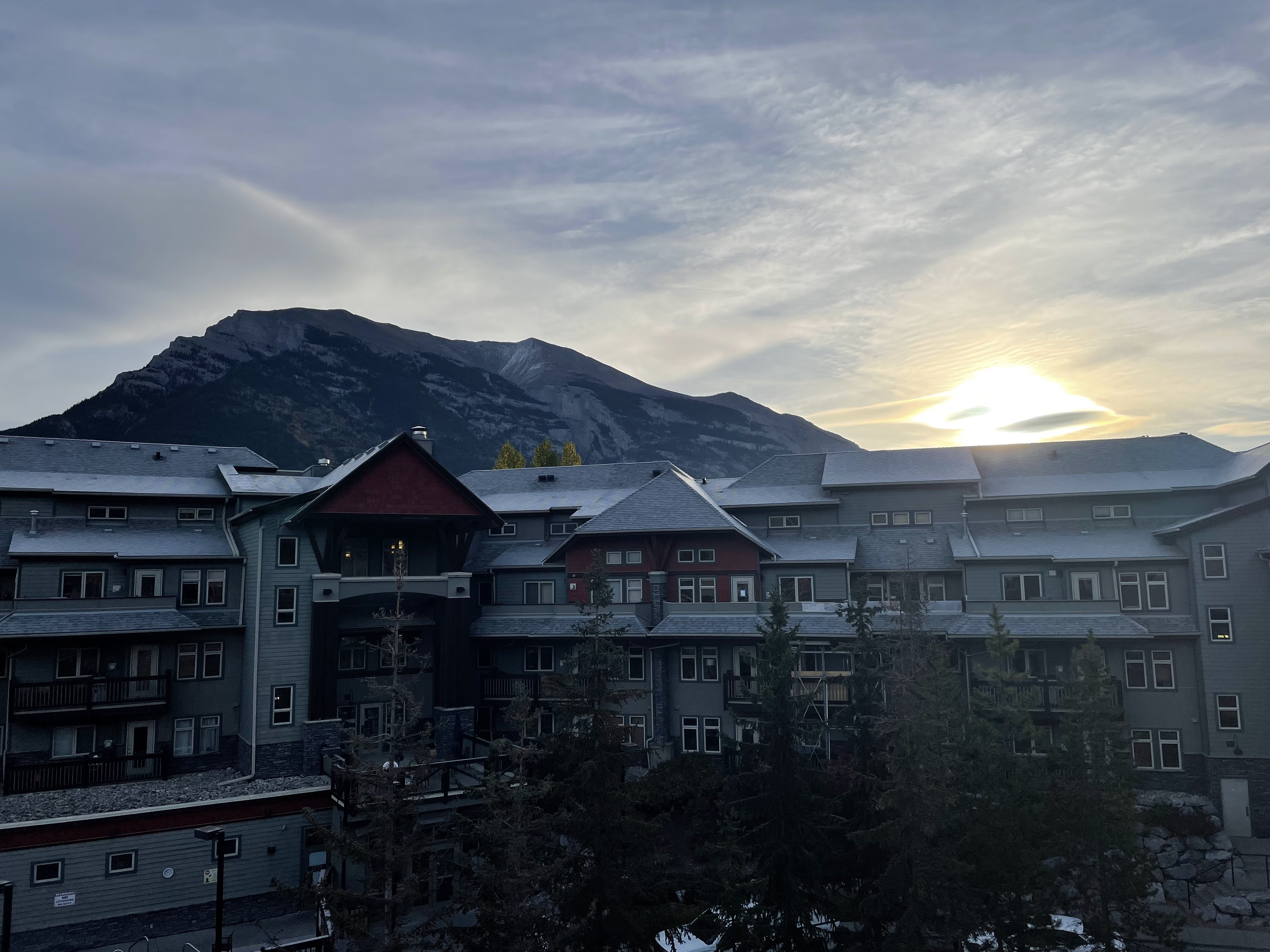
Sunrise here is right around 8 AM currently (and getting 2 minutes later per day), but the sun doesn't come into the valley until closer to 9 AM.
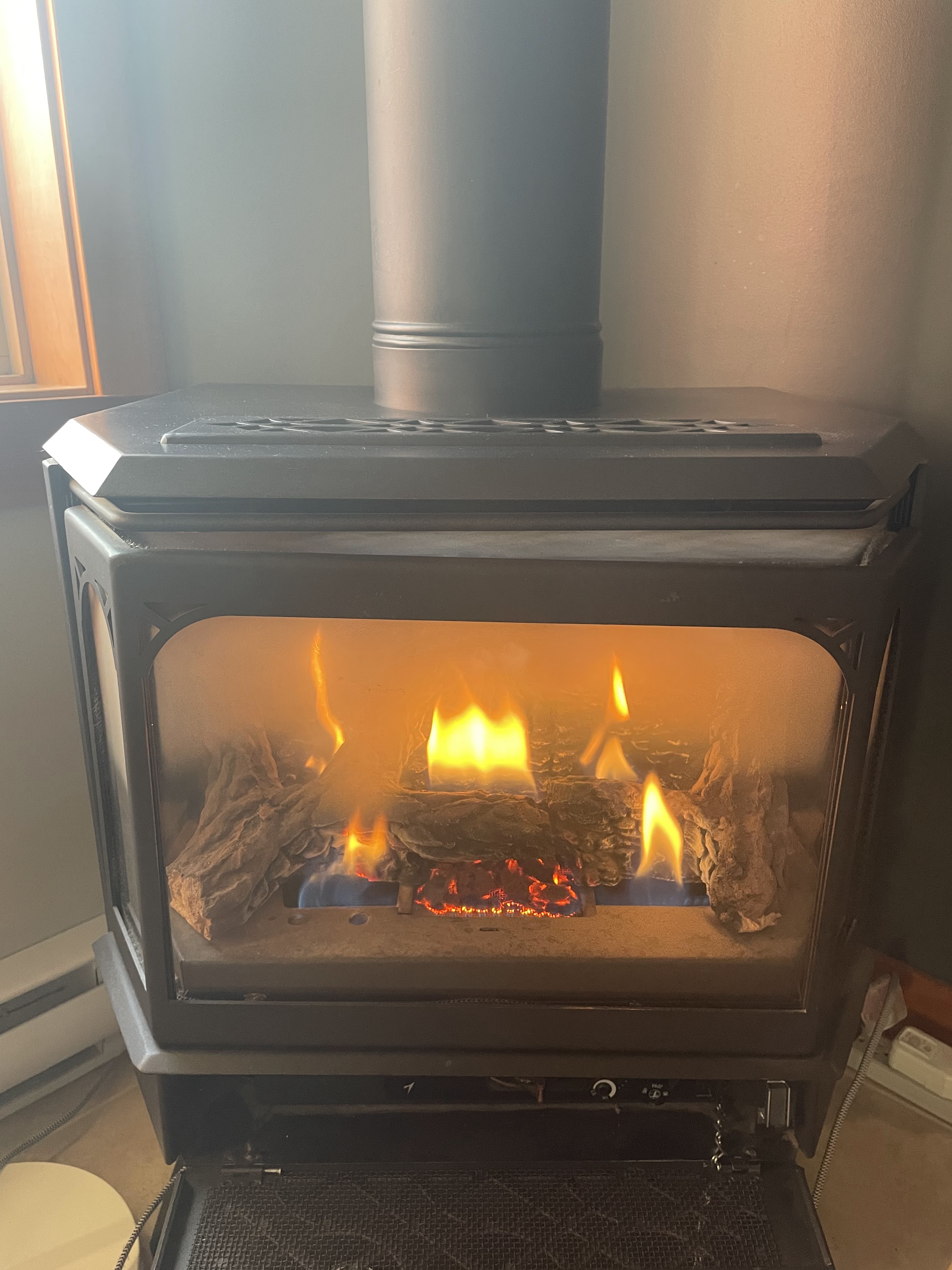
It was quite cold in the condo this morning, so I put the fire on to address the complaints.
I stepped out onto the balcony to survey the pool situation; it was about 33F as the sun peeked over the mountains.

We gave it another half hour before going out to explore; we were getting rather hungry and didn't have anything beyond granola bars or equivalent, so we bundled up and went out for a walk.


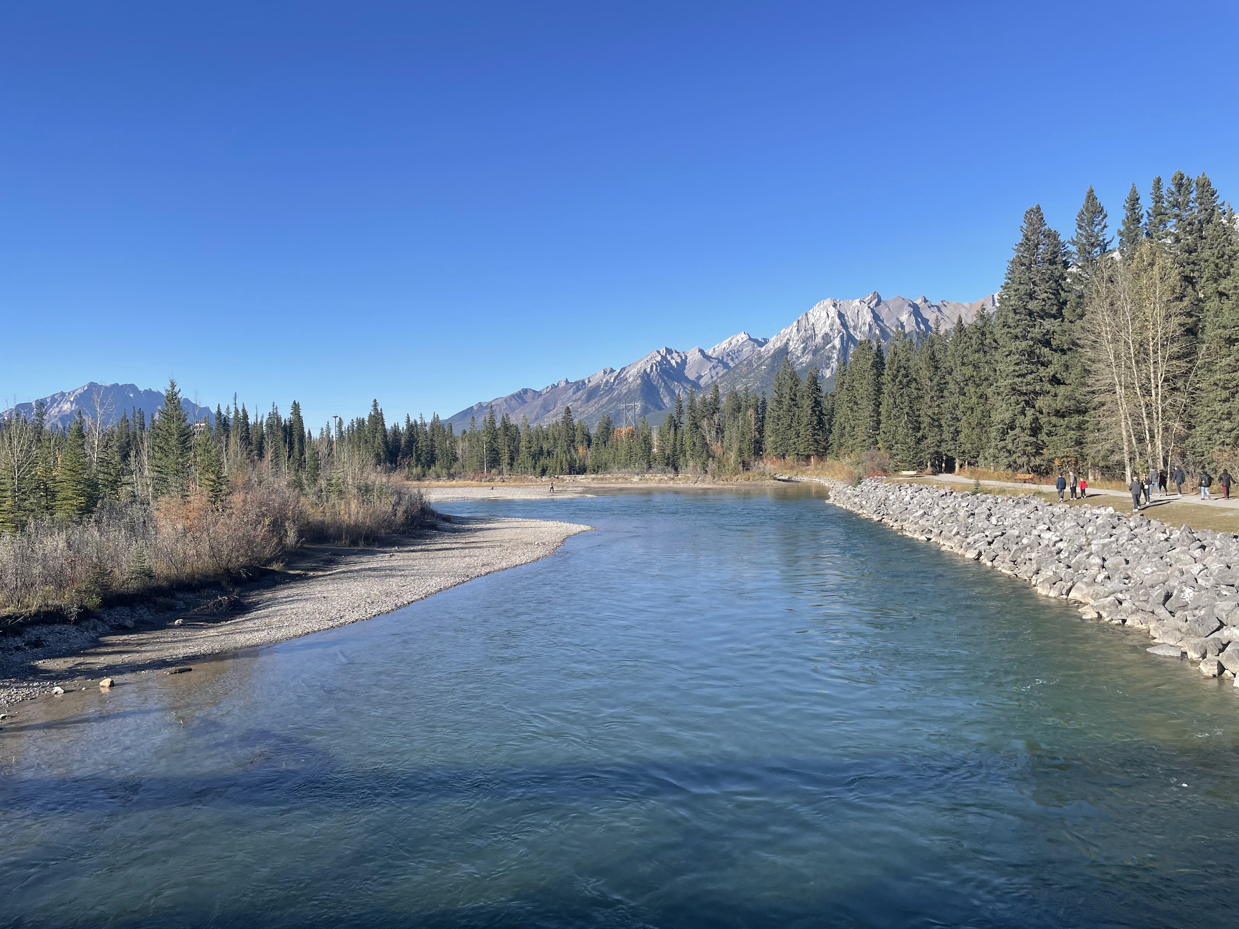
It was maybe one mile to downtown Canmore, and we opted to use the trail along the river.


See if you can spot the cleverly hidden cell tower.

The trail eventually connected to the Policeman's Creek Boardwalk, which was still frosty but guided us through some lovely terrain with scenic views in every direction.


It seems like Canmore isn't an early-morning kind of place, perhaps for obvious reasons. The locals were out for their morning strolls and dog-walks.


This sign seems unnecessary; every trash can we've seen here is bear-proof. Or at least bear-resistant. Also why is it chained to a post?

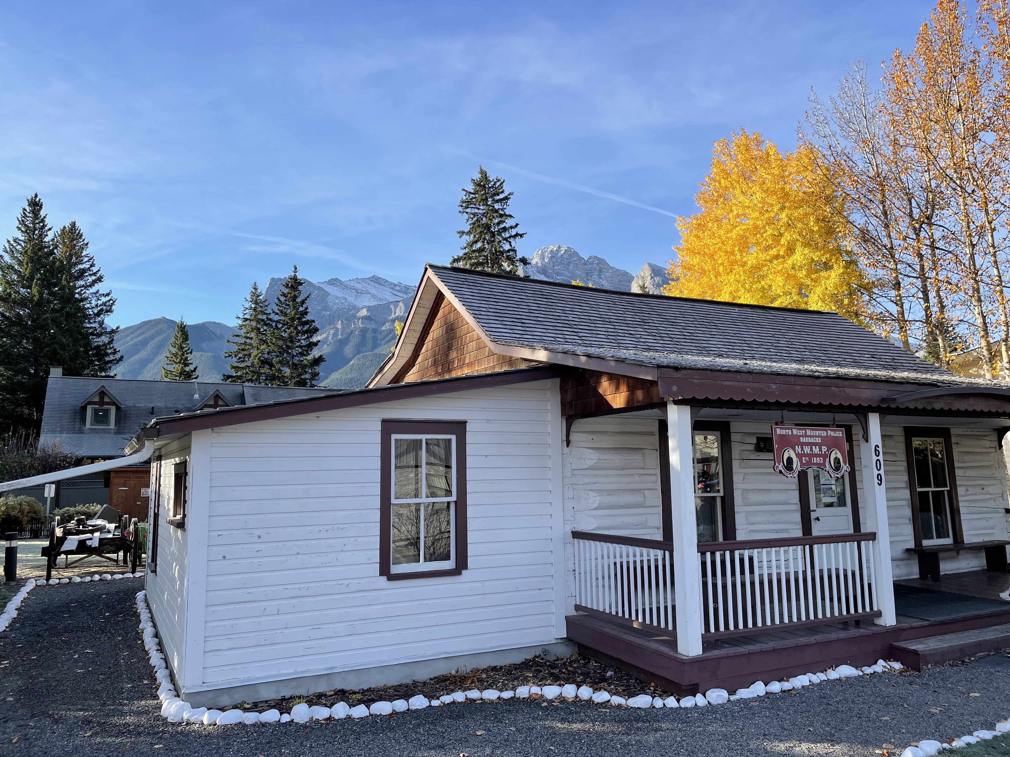
As we entered town, we stumbled upon the historic North-West Mounted Police barracks, but were on a mission to find sustenance so only stopped for a photo moment.
Several blocks of main street were closed to cars; I thought perhaps this was a sign of upcoming Thanksgiving weekend festivities, but apparently it's pedestrian-only for the entire five-month "season".

As you can see, it was not very busy, possibly because it was barely above freezing at 10 AM.

In no particular rush, we enjoyed a leisurely stroll up and down main street. We popped into Rocky Mountain Bagel Co for some egg sandwiches (I got mine on a maple bagel, which was delightful), Eclipse Coffee Roasters for tea and coffee, and then stopped for a bit of shopping.

We didn't acquire any bison-leather goods, but did pick up a can of bear spray. This required signing some sort of waiver acknowledging that it's dangerous, not to be used on people, is explosive and flammable, etc. It also came with extensive, human-delivered instructions and hike recommendations.

On the way out of town, we stopped at a bakery to grab some sandwiches for later, then did a brief tour through a grocery store to acquire a few essentials.
By the time we walked back to the condo along another multi-use trail, it was probably noon already.
We swapped our strolling-about-town outfits for hiking-in-the-woods gear, outfitted our backpacks for the rest of the day, and headed out in search of adventure.
Our intended hike destination was the Grassi Lakes trail, but first we had to acquire a Kananaskis conservation pass to authorize us to park/hike in Kananaskis Country. The (two-year-old) guidebook, as well as all of the literal signs on the side of the road, indicated that we could purchase this at the visitor center, so we drove over there.
They were excited to inform us that it was all handled via their website these days, but also gave us a map and some helpful suggestions. More on that later.
Conservation pass handled, we headed up into the valley, parking at (what I suppose is part of) the Rundle Forebay Reservoir (or maybe the Canmore Reservoir?), by the Grassi Lakes trailhead.

Yes I know my finger is in this photo; it was blocking the sun.

We didn't want to carry sandwiches up the trail because they weren't wrapped well and (perhaps more importantly) "bear country". We also didn't want to wait until 3 PM to eat, so... even though we'd eaten (a light) breakfast only three hours prior, we decided to picnic at the water's edge before hiking.

I think this is the first time we've ever seen someone paddleboarding in boots. Also, I think pets are rather explicitly prohibited from being on/in the water, including on boats. 🤷♂️


Moments like this remind me of something that was posted to Twitter years ago...


There were two trails: the "interpretive trail" offered better views, was more interesting, but more difficult; the "upper trail" was wider, easier, but sounded boring.
We opted to make a loop, going up the trail with better views and coming down the easier, boring trail.

There were numerous places where water was flowing over the trail, or using the trail as a stream bed. This would've worked better as a live photo or video, I guess, but there was water flowing down the rocks on the right, across the trail, and down the hill.


As we gained elevation, the views improved dramatically. In the distance, you can see the parking lot and where we ate lunch. In the foreground, there's a hydroelectric plant and power substation.


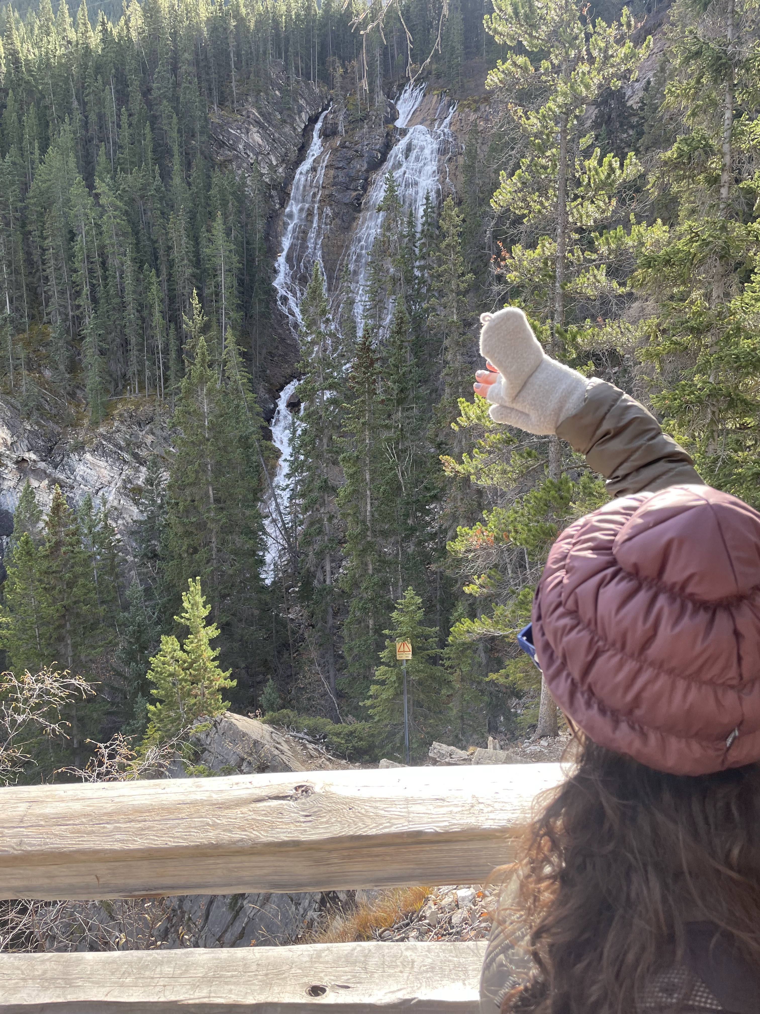
One of the viewpoints afforded a lovely view of the Grassi Falls, across the valley.
Up until that point, the interpretive trail had been fairly easy. There were some wet/muddy spots, some rolling hills, and a constant but gradual elevation gain.
After the falls viewpoint, though, it turned steep and rocky.


At some point there was a seemlingly-neverending series of stone staircases, interspersed with beautiful views of the valley below.

From up there, we could see all of Canmore, and traffic flowing on highway 1 in the distance.

Finally, at the top, we reached the namesake Grassi Lakes. The AllTrails page for the interpretive trail suggests it's just under 700 feet of elevation gain, but doesn't mention that it happens almost all at the end. Also, hiking around 5000 feet above sea level makes it more difficult.


In the distance, Ha Ling peak blots out the sun. The cheerful young man who sold us the bear spray suggested we might be interested in climbing to its summit, which was about a six-hour hike. We're still trying to figure out what gave him the impression that we'd be up for that challenge.

This important piece of photographic documentation helped me figure out why I got what-might-be-construed-as a minor sunburn, today.

The glacial meltwater of the lakes is crystal clear, allowing the blue and green algae to thrive on the frigid bottom.


We followed the trail in a sort of figure-eight pattern around one lake and then most of the way around the next.

The trail around the back of the valley goes to the "rockclimbing area", which we were happy to admire from a distance.

This is the current contender for Best Sign of this trip, although it's too early to be sure.

Instead of getting our skulls cracked by falling rocks, we made our way back through the middle of the two lakes, and then back down the hill via the boring "upper trail".


It was so boring, I didn't take a single photo.
Back at the parking lot, we evaluated our options for the rest of the afternoon. It was around 3 PM, so we had plenty of daylight left. There was allegedly another beautiful lake only two miles up the road, so we decided to squeeze that in while we were in the neighborhood.

The guy who gave us the map at the visitors center had mentioned that this turned into a dirt road, but we didn't realize that line was literally 20 feet up the hill.

I missed the chance to get a shot of the "Avalanche Area - Do Not Stop" sign.


Whitemans Pond was, indeed, beautiful.

This view reminded me of some the alpine lakes we visited in Switzerland, but with less snow.

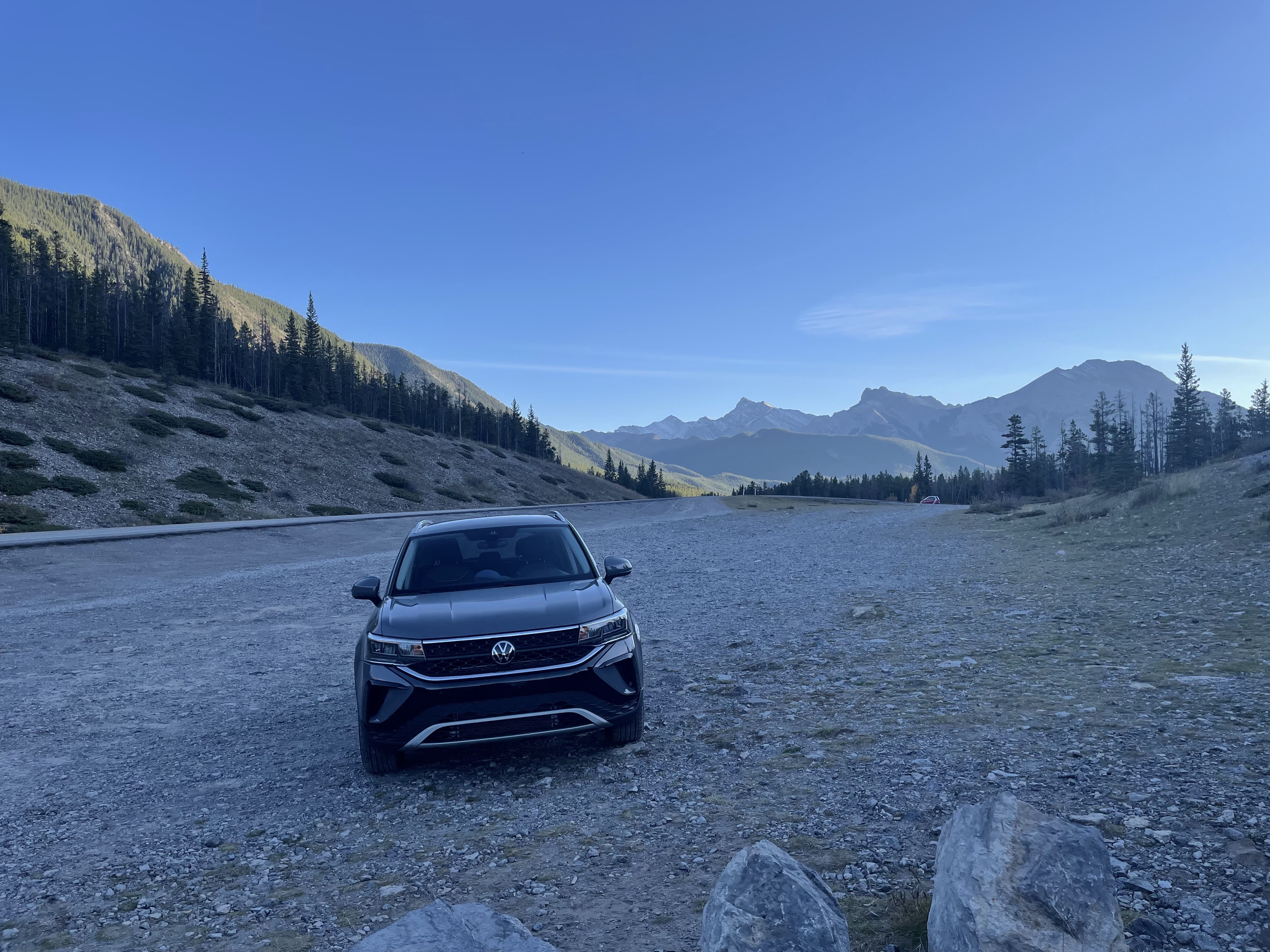
Again, Ha Ling peak's foreboding presence was inescapable. We were only 1/2 a mile from the summit trailhead, by this point.


Volkswagen for scale.

Having finally satisfied our lake quota for the day, we once again risked our lives by driving through the avalanche zone, back down to Canmore, and found a parking spot on the street near one of the trails along the Bow River. Now that it wasn't barely above freezing, we were going to finish our exploration of Canmore.
Here, you can see Sabrina about to launch herself into the air to reach the handle to close the tailgate of the Taos.

It was so nice to be walking on level ground again, as we followed the path to the river.


Once we arrived at the shore of the Bow River, we stumbled upon a multi-infant photoshoot that looked dangerously close to ending in tragedy. Nobody went for a swim, at least not while we were watching.

The true star of the show here is obviously the Canmore Engine Bridge, as made famous by Episode 6 of HBO's The Last of Us.


The views from the bridge were stunning; the brisk morning that turned into a partly-cloudy day had finally relented, yielding blue skies and pleasant weather (as long as we stayed in the sun).


Farther along the trail. at the end of the (unnamed, non-famous) bridge over the other fork of the river, we encountered another hydro plant. Unlike the previous one, this one is labeled on the map.

We sauntered down the western shore of the river, enjoying the peaceful afternoon.


Crossing back over the river on Bridge Road, we looped back up to the car, completing a loop of about a mile and a half.

Along a short stretch of trail that led back to the road, we encountered (not for the first time) an unfamiliar and rather loud bird. I don't currently know what it is, but I'll satisfy this curiosity later.

It was approaching 5 o'clock, and our vague plan was to head down to Kananaskis Village for dinner. We didn't know much about the Village, except that maybe it was related to the 1988 Olympics that was held in Calgary, with some nordic events in the Canmore area (this is the sole comment Fodor's has on the subject), and that the map guy at the visitors center was enthusiastic about it. His only selling point were that it was "worth seeing", and had been the site of a previous G8 meeting. Wikipedia tells me it's also the site of an upcoming G7 meeting.
We took the scenic route along the original road through the valley, predating Highway 1, admiring the scenic views of the Bow River flats along the way.
Once we had gone east far enough, we turned south and headed toward the hills.
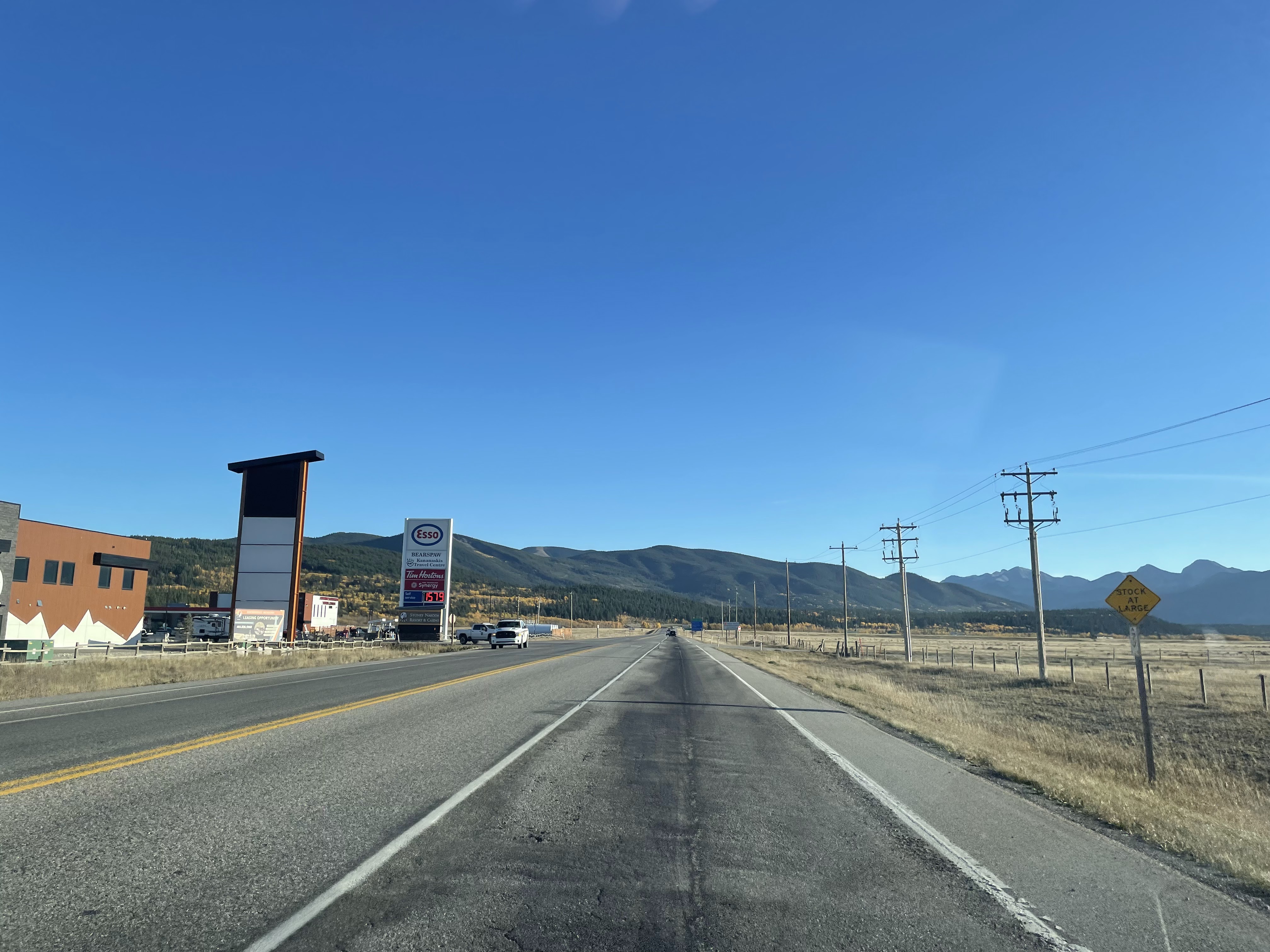
Several of the highway exits that we briefly stopped at last night, to admire the aurora, had (what we might call) cattle guards to keep wildlife off the highway. Every one of them has a warning sign "TEXAS GATE", which we thought was peculiar. It turns out to be strange enough that someone wrote a news story about the issue.

"STOCK AT LARGE" was a new one for us, though. Presumably, it means that there are cattle roaming free, with no fences to keep them off of the roads? That gas price works out to something like $4.35/gallon, in case this is ever a useful data point in the future.
The vibrant yellow of the larch and/or aspen trees was inviting us up into Kananaskis Country. It took a good while to get there, but the view was nice.


Despite it being a solid 90 minutes until sunset, the mountains were starting to cast long shadows.

We made a brief stop to admire the view at Barrier Lake, which is apparently another reservoir.

If you look carefully, you might see that someone else had stopped here for a nature walk.

I got a good chuckle out of seeing a Smart Car out here.

We were surprised to find the Village crowded, at least judging by the packed parking lots. We managed to find a space, and took a brief stroll around.


We weren't quite sure what to expect, but were a bit surprised at how little was here.

It did have abundant views, as one might expect. With the sun fading fast, the temperature was already dropping; we came prepared, though.

Our best dinner options were inside the Kananaskis Mountain Lodge, which was easy to find because it's the largest structure for miles, and also thanks to this helpful sign.

We enjoyed a delicious dinner with a side of some serious people-watching. While waiting for drinks, I reviewed what my iPhone thought we had done today, which was something approaching 21,000 steps (to go not quite 8 miles), and "26 floors" of flights climbed.

After dinner, we crashed a fireside s'mores offering that didn't explicitly say it was only for resort guests. It might have been open to everyone. Or, as Sabrina put it, "who else would be here?" except us.


Driving back along Highway 1, we could see the glow of the last light over the horizon. To our eyes, it had a distinct green tinge; I stopped at the last exit before Canmore (Three Sisters Parkway), but the iPhone camera didn't pick up any green. It did pull a neat HDR Big Dipper out of the night sky, though.

This one definitely look aurora-ish to me, though. Green on the right, purple on the left?

Back at the condo, we unloaded and unwound briefly, then spent about an hour in the hot tub to soothe our legs and talk to strangers.
The aurora forecast was wrong, of course. There was no visible aurora tonight. Perhaps we just got unbelievably lucky last night.
Tomorrow, we'll be in Banff.
No comments:
Post a Comment