We checked out of our Airbnb in Canmore around 9:30 AM, packed up the car, and drove northwest about 20 minutes to Banff.

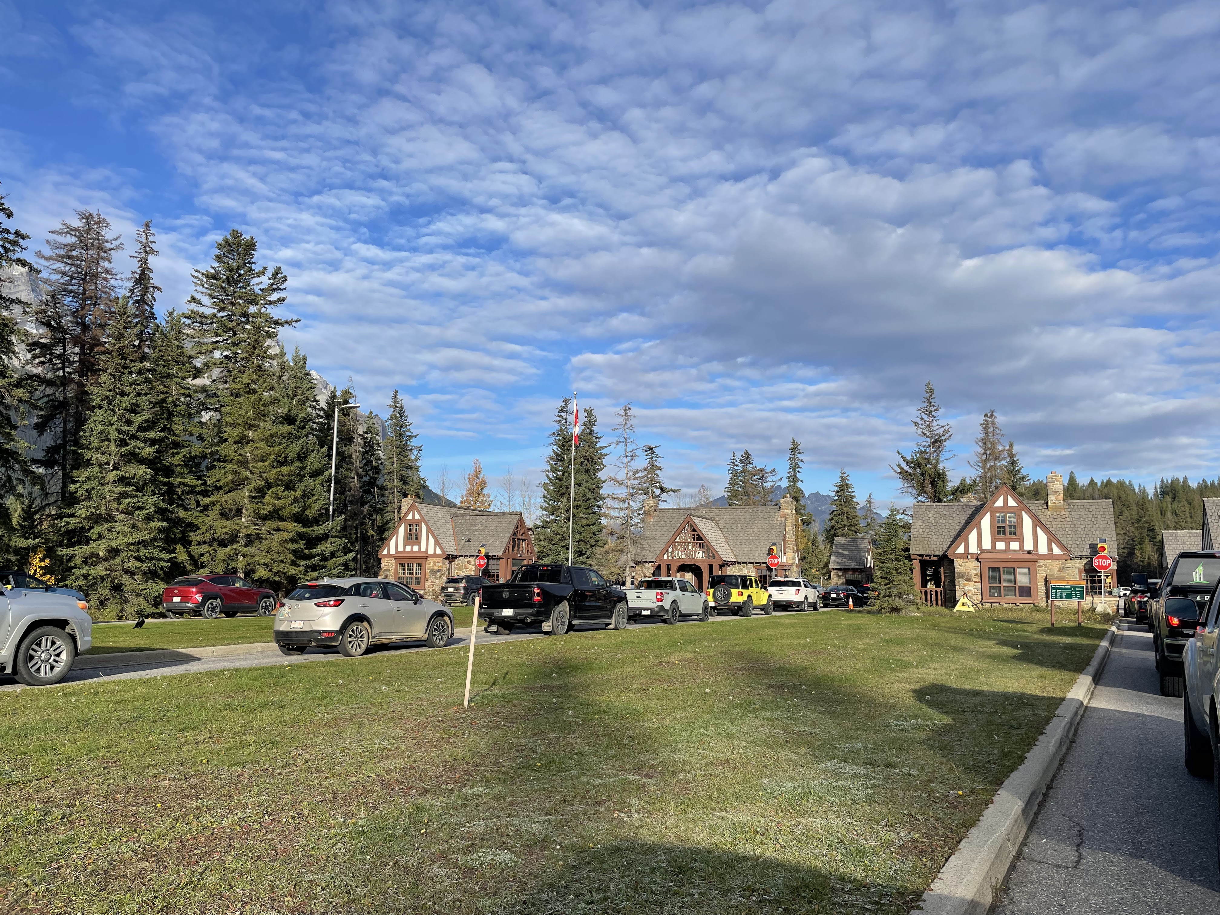
Upon reaching the perimeter of Banff National Park, there is essentially a toll booth in the middle of the Trans-Canada highway, with a bypass for through traffic.

Each lane had two windows, so we were through the line in maybe five minutes. Somehow a two day park pass issued before 10 AM on Saturday doesn't expire until 4 PM on Monday, which was a pleasant surprise.
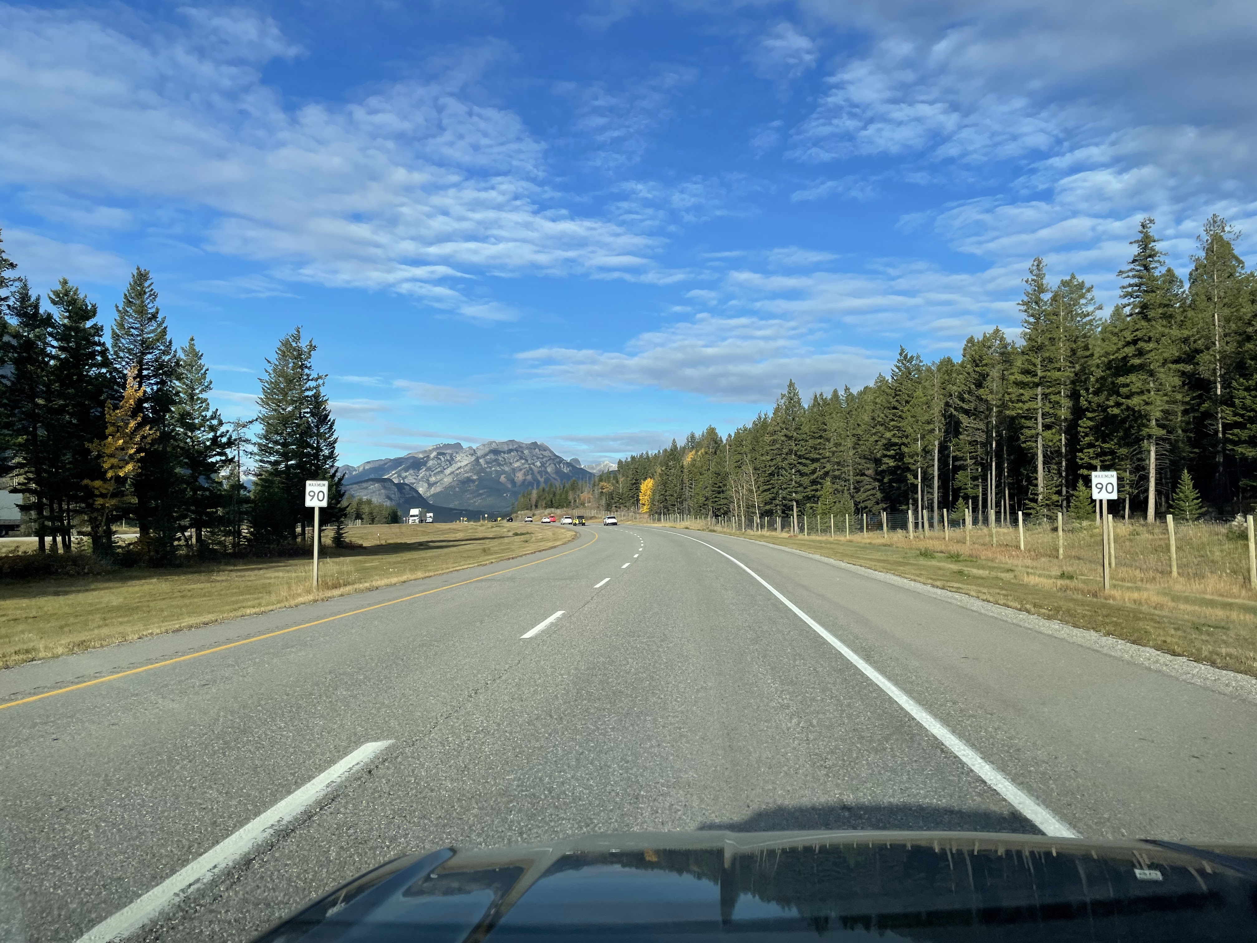
As usual, the incredible views while simply driving along the highway were distracting. Thankfully the rental car has fancy features like "keep me in the lane".

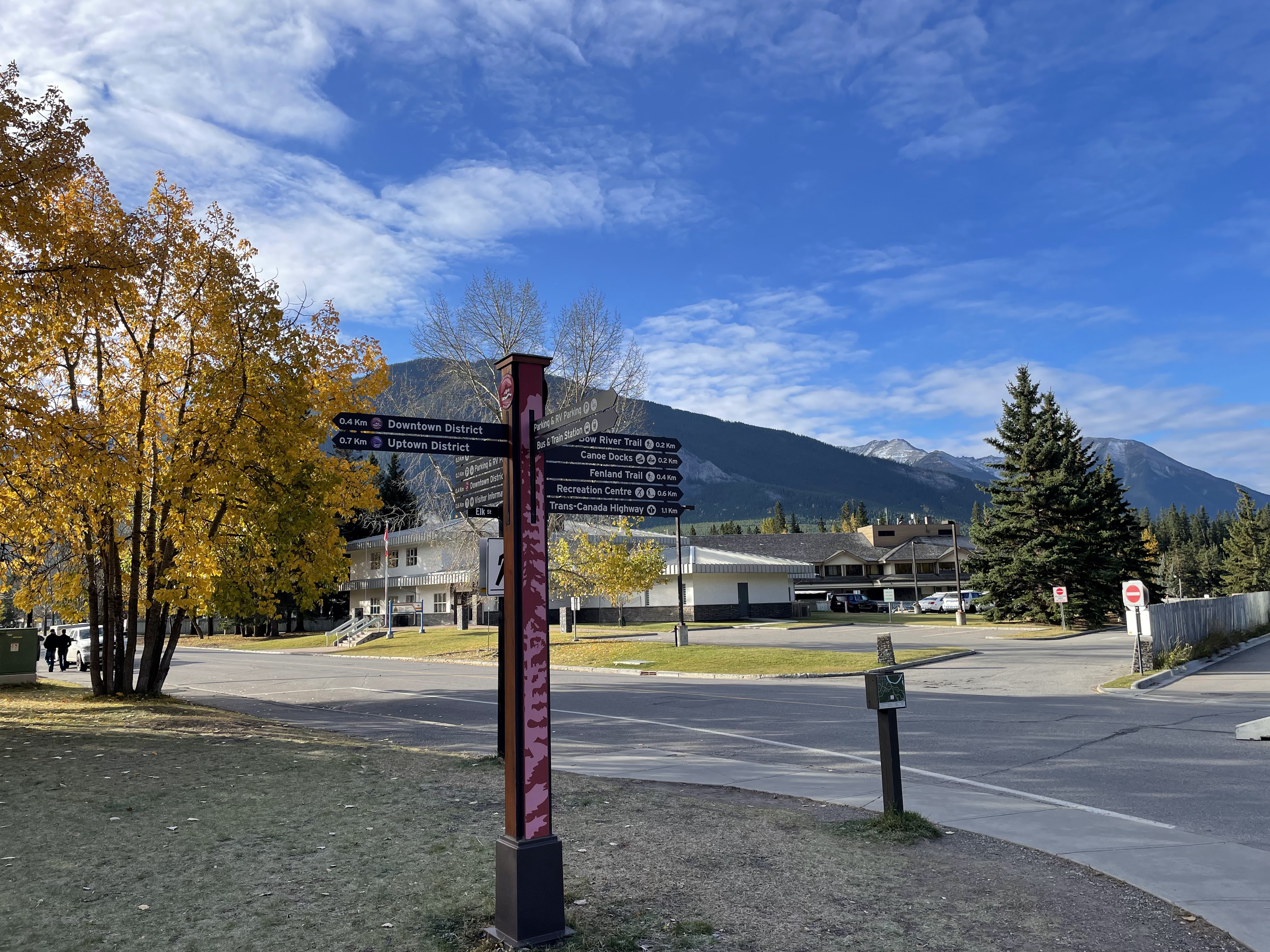
All available data suggested that Banff would get crowded and that most of the parking downtown was not free, so we parked in the free lot at the transit hub (bus station) and walked the short distance.

It seems like many shops in this area don't open until 9:30 or 10 AM, so it wasn't crowded yet. The brisk weather (maybe 35F?) probably helped, too.


We'd had first breakfast back in Canmore, but popped into Wild Flour Bakery for second breakfast and coffee. Sabrina opted for fancy tea at the tea house, next door.

We strolled around town a bit while drinking our beverages and warming from within, but ran out of town fairly quickly; According to Wikipedia, the entire town proper is just over 1.5 square miles. Also, the street names are adorable.
Anyway... it's a very touristy resort town, full of restaurants of all types, souvenir shops, tour companies, and hotels. None of this was a surprise, but it isn't exactly what we came here to find.

Instead, we wandered south out of town, over the Banff Ave bridge, toward the trail along the Bow River.

At the end of the bridge, we skipped the Cascade of Time Gardens (isn't really garden season), in front of what I have just learned was the Banff National Park Administration Building.

We sauntered along the river, soaking up what little sunshine filtered through the trees, heading east toward the Bow Falls Trail.

If you can't be bothered to zoom in, the sign is admonishing locals for setting a poor example of elk safety:
"ELK NEED SPACE
Locals know elk may see humans and pets as a threat—but we still get too close. Set an example for visitors: stay 30 m from any elk, especially in rutting and calving seasons, and never get between these wild animals."

The sun was finally starting to warm up the day, but there was a frigid breeze coming off of the river.

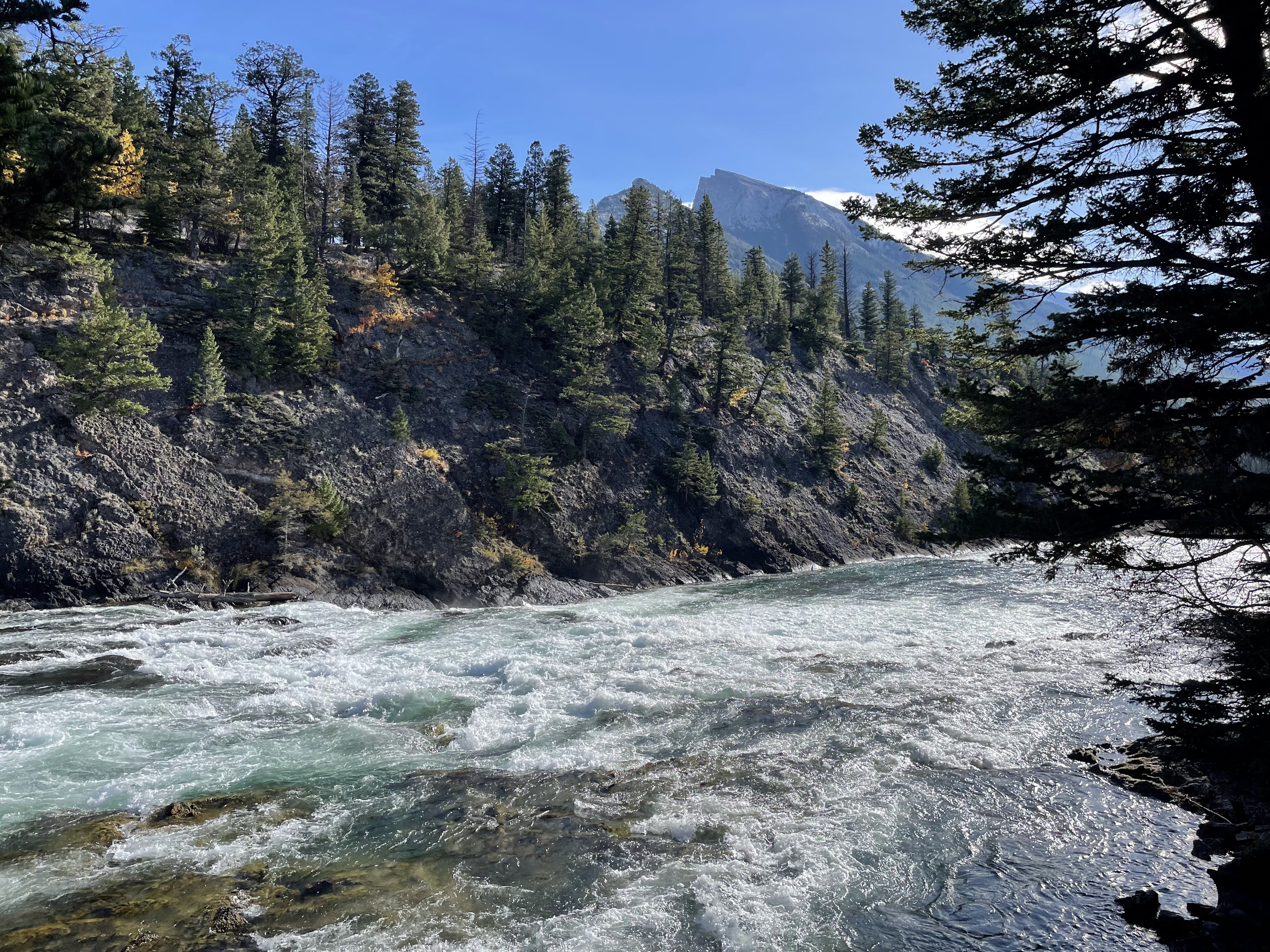
As we got closer we got to Bow Falls, the water accelerated into rapids, adding a relaxing white-noise soundtrack to our walk.
Pro tip: when Google Maps says a route is "mostly flat", it doesn't necessarily mean anything. I had briefly suggested we rent bicycles in town for this mini-adventure, but was suddenly glad we hadn't bothered. Also, we are fair-weather cyclists.

There was also a trail on the north side of the river, but no crossing anywhere nearby.
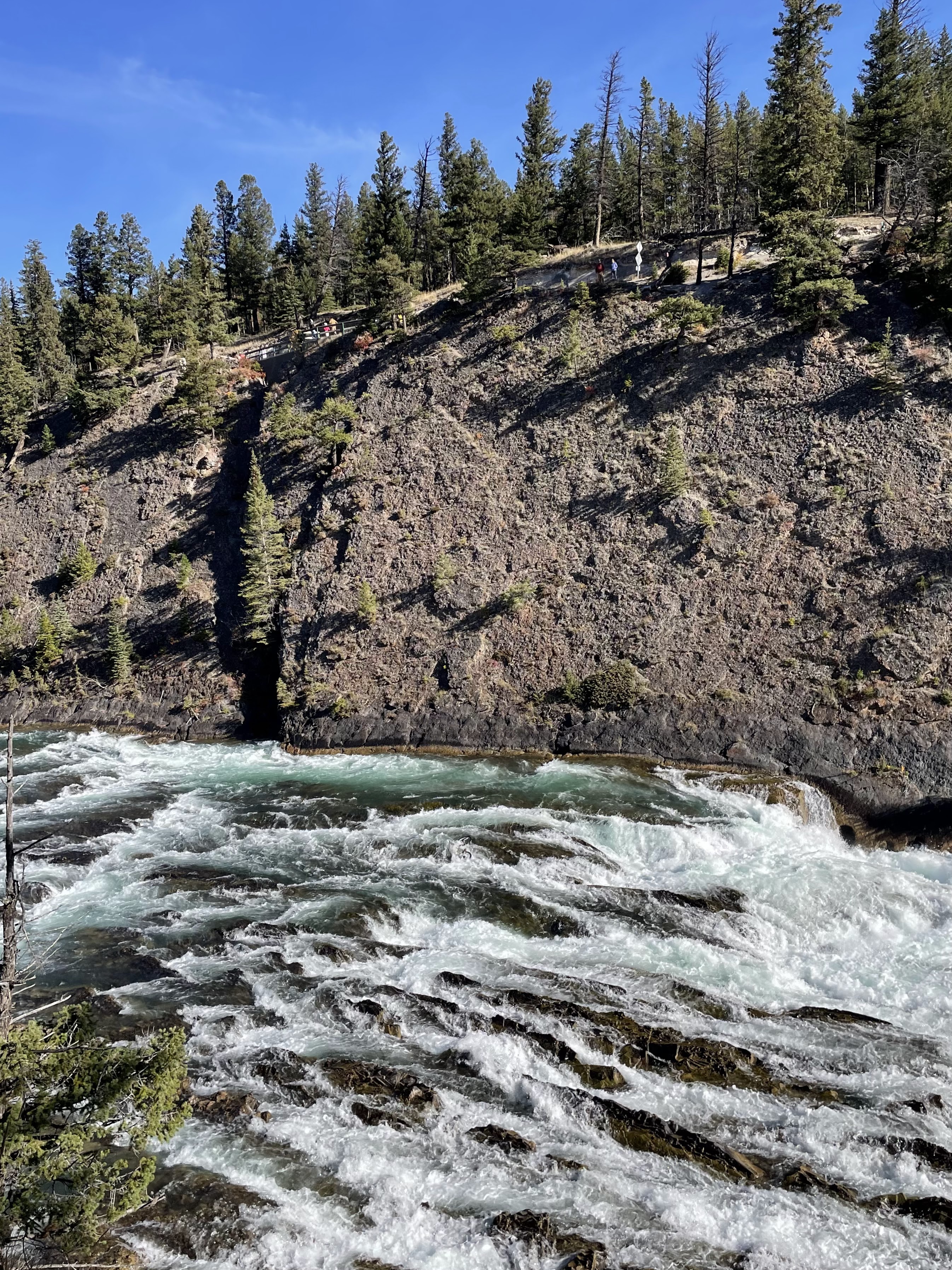
The vista from the viewpoint at the top of the falls was splendid and the water looked very inviting (to me, only).

The falls themselves are nothing amazing, except maybe for the speed at which the water sprints through the channels it has carved into the rock. Use your imagination.


The scenery at the bottom would make a wonderful (if challenging) jigsaw puzzle.

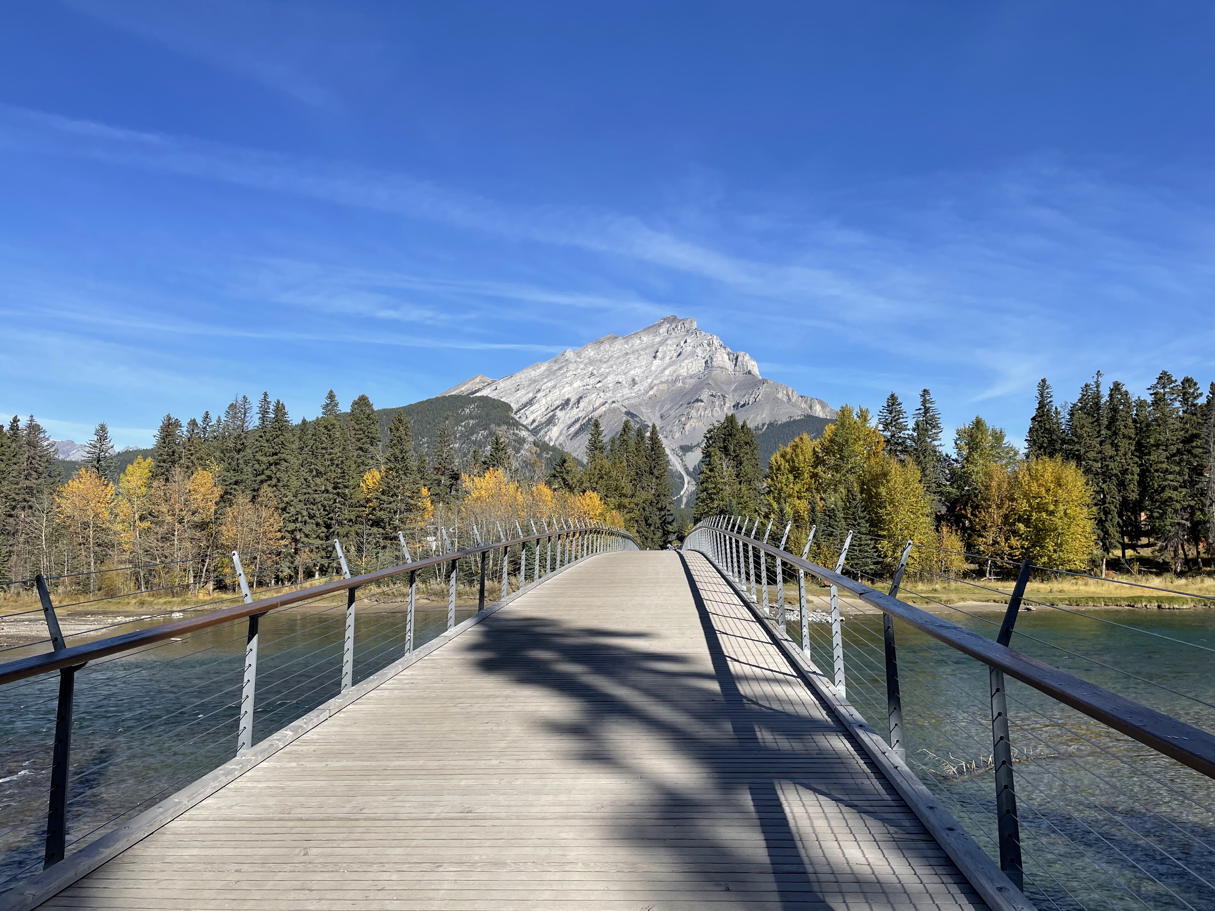
We'd walked about a mile since getting tea and coffee, which had run out long ago, so we turned around and strolled back to town, crossing at the Banff Pedestrian Bridge. It was noticeably bouncy, which I have just learned is due to the center span being ~260 feet and the entire bridge being made of wood. To quote the structurecraft.com page I just linked: "The 80m clear span - perhaps the longest of its kind for a timber bridge..." Yes, perhaps. I love that this site exists, btw.
I think this is Tunnel Mountain looming over the town, from the east. It features prominently in several photos, below.

Here we have the Banff Avenue bridge, that we crossed earlier, seen from the pedestrian bridge.


It was noon-ish as we walked back through town, while deciding on the plan for the afternoon. We decided to sit down for lunch somewhere to assist in the decision-making process.
The Elk & Oarsman restaurant boasted a rooftop patio, which was appealing. They were advertising their Thanksgiving dinner in several prominent locations (and also in a popup on their website, at the moment).

It was about 50F, but somehow that seemed reasonable for al fresco dining, with the help of some intense sun.

There's Tunnel Mountain, again.

As one might expect, there was a lot of elk on the menu; it makes a tasty burger.

Earlier, we had seen some signs for free shuttles to the Banff Gondola, which was on my "to do if there's time" list. The shuttle schedule seemed... unappealing, however, and we figured it couldn't be that busy, given that it's the end of the season. (The Banff Upper Hot Springs had also briefly been on that list, but it became moot as it's closed for maintenance, and it had already been struck from the list, anyway.)
Knowing full well that it was a tourist trap, and trying to ignore the extra-steep, dynamic price (due to the compound effects of "weekend" and "Thanksgiving"), we decided to risk it and just drive to the gondola base station.
On the walk back to the car, we realized that town had gotten quite a bit more crowded in the previous few hours. We enjoyed the wide array of apparel choices that different people felt was weather-appropriate, ranging from heavy winter coats and ski pants, to shorts and flip-flops.


It took longer than it should have to drive the 3.5 miles from the transit hub to the gondola, what with the only route being through the middle of town. Once we arrived, we were pleased to learn that it was, in fact, not extremely crowded. It was "employees screening cars and directing traffic"-crowded, but not "sorry, you need to take the shuttle"-crowded or "park half a mile down the road and walk"-crowded.

Anyway: we were able to drive straight in, find a parking spot, walk up to the ticket window, and buy a ticket to go up immediately. I love it when an improvised plan works out.


The gondola is quite steep as it ascends a few thousand feet up to the summit ridge of Sulphur Mountain. Along the way, we were treated to a view of Banff, Tunnel Mountain, and the Bow River. The large building at the base of Tunnel Mountain is the Fairmont Banff Springs (hotel).

There is a steep switchback trail that zig-zags below the gondola route; we looked down in horror at the rugged terrain that was barely recognizable as a trail, occasionally passing over a family slogging their way up the mountain.


I suppose that's probably Cascade Mountain behind Banff. The view from the top was breathtaking; I'll refrain from making an elevation joke. We couldn't have asked for better weather, either.


This is where the Sulphur Mountain Trail arrives at the top. Hard pass.

Out along the ridge, reachable by boardwalk and many (so many) stairs, sits the Sulphur Mountain Cosmic Ray Station.

In the distance, we could see Lake Minnewanka (which we might try to see on another day, assuming we fall short of the lake quota).

Having little interest in the (three!) restaurants or the gift shop at the top gondola station, we circumnavigated the observation deck and then joined the steady trickle of tourists making the pilgrimage to the Cosmic Ray Station.


Along the way, there were plenty of viewpoints and observation decks, some of which had informational signs and history tidbits.

Because we're in Canada, every sign has to be in both English and French, of course, despite being at least 1500 miles from Quebec.

After what felt like climbing 1000 stairs, we made it to the historic science station, had a lengthy look around, in all directions, and then headed back.

Their pictograph game is on point, with some of these signs.


I speculated about how annoying it must be to hike out here with a gas can, periodically, in the winter, to run this snowblower that they keep on the largest observation deck at the end of the boardwalk.


Back at the gondola station, after another probably-1000 stairs, we enjoyed a peaceful ride back down the mountain. Total time spent at the top: 45 minutes.
As people enter the gondola cars, a staff photographer snaps a pic that you can buy in the gift shop, below. Tourist trap confirmed. I checked on the way out; it was $20 (CAD) just for the digital-only option.

After we made it safely back to the bottom, we got out of Banff and hit the road to our next activity for today: hiking Johnston Canyon. We estimated that we'd need at least two hours there (but maybe three, for a safety margin?), and didn't want to be hiking down in the dark, so wanted to be there by 4 o'clock at the latest.
The trailhead parking lot is reached via the scenic Bow Valley Parkway (which is apparently sometimes closed to all cars and turned into a cycling route, but not in October).

We also thought that going at 4 o'clock would mean it wouldn't be busy, as everything we'd read about the popular attractions in Banff National Park, including this one, ended with "go early in the morning or late in the afternoon to avoid the crowds".
I think we got the last available parking spot.
By the time we repacked our packs, changed shoes, filled water bottles, etc., we were bumping up against that 4 PM deadline. This photo was taken at 4:01. 😆


We opted for the Upper Falls route (but not the additional two miles, each way, to the Ink Pots at the top). It wasn't clear to us if the total distance to the upper falls was 2.6 km, or if that was 2.6 km past the lower falls (meaning 3.7 km total).
Side note: it has been slightly challenging to think (and converse) in kilometers, meters, km/h, celsius, etc. (In a "fun and challenging" way.) It's ridiculous that we don't use the metric system in the United States.

Sabrina was not thrilled to discover that some of the trail was of the bolted-to-the-canyon-wall, skywalk-style, type.


This canyon hike reminded us of some gorge trails in the Finger Lakes region, like Watkins Glen or Buttermilk Falls. There's probably one or two more that I'm not remembering at the moment.

At the lower falls viewpoint, there was a (presumably perpetual) line of people waiting to take the perfect Instragram shot at the end of the platform, framing the waterfall through a sort of cave in the rock.

We had absolutely no interest in waiting in line to see this, so we immediately continued to the upper falls trail. Here you can see me being smug about how much better we are than the people below. We assured each other that the line would be gone on our way back down, and we'd just see it then.


It turns out there are maybe half a dozen smaller falls between the lower and upper falls. I guess they don't merit their own names, but I liked several of them very much.


As we approached the upper falls, the walls of the canyon turned into slick limestone walls, reminiscent of something one might see on a cave tour, fed by a steady trickle of water from the rocks above.

The star of the show is just around this corner, visible from the steel platform that hangs out into space, above the river.

It was flowing a decent amount of water, in my opinion, given the season. Again, use your imagination.

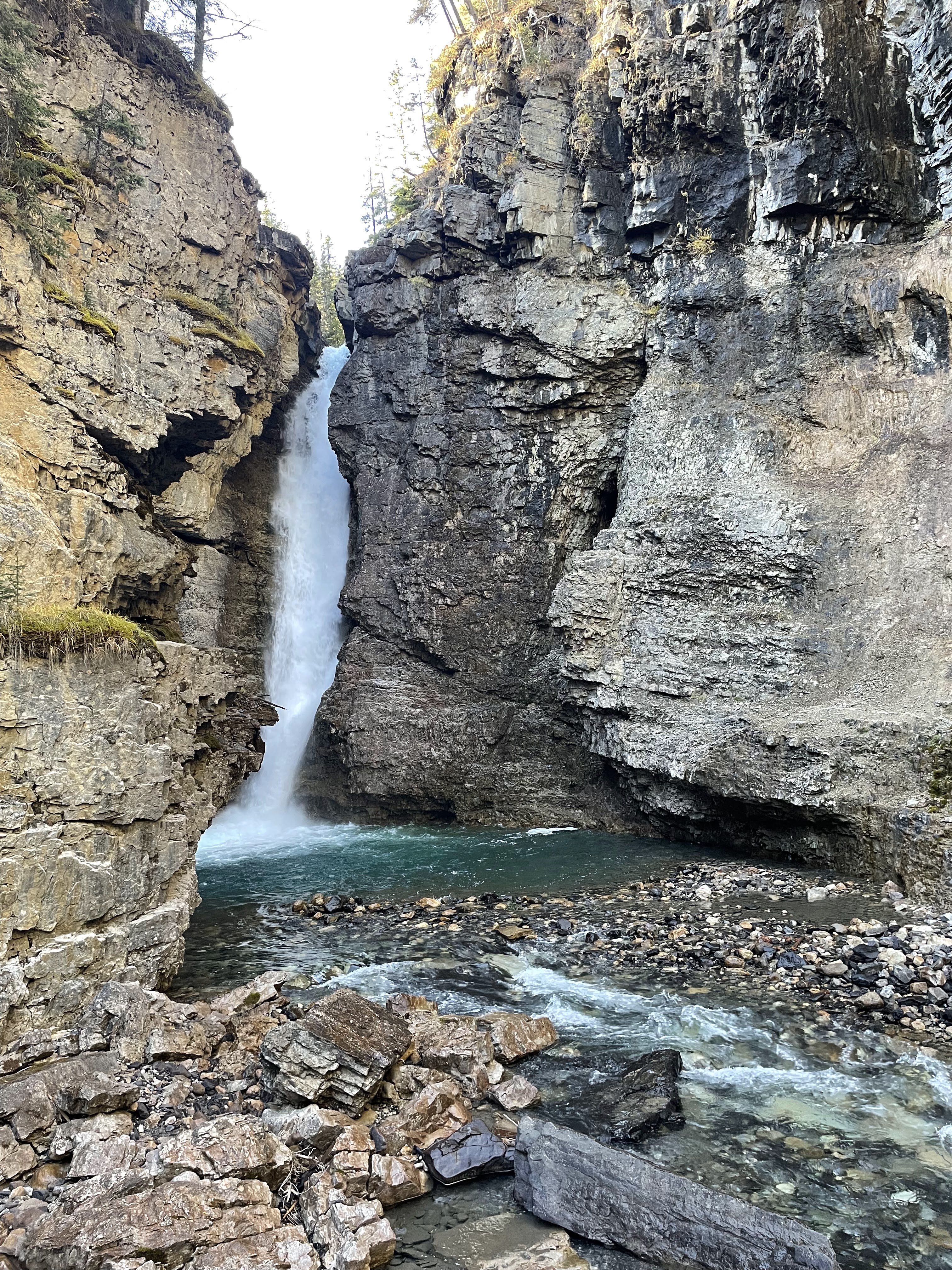
Closeup view of the limestone-coated canyon wall.

There was also an upper viewpoint, sort of above the upper falls, which we obviously needed to see.

It felt like we might see this tree topple into the waterfall, if we just waited a few more minutes.

Having summited our afternoon objective, we sat on this convenient bench and had a snack before descending.

The upper trail length was not in addition to the lower trail; it had taken us slightly longer than an hour to get to the top. Only once did Sabrina panic when she thought she saw a bear, only to realize a moment later that it was the bottom of an upturned tree stump. (She then spent the next 20 minutes nervously scanning the hillside above the trail while I speculated about how interesting it would be to see a bear.)
At some point on the way up, a man on his way down showed us a photo of a child and asked if we'd seen him (we had not). Then asked if we'd send him down, if we found him on our way up. I looked closely at the photo, in case we actually did come across the kid. We did not.
On our way back down, we had another interesting human encounter: We were leaning on the railing above the lower falls viewpoint, discussing how absurd it was that there was still a line of people waiting. Apparently a young man on his way up the trail took a photo of this moment, from above, and decided that he needed to share it with us. I know this because he raced back down the trail and caught up with us, as we had already continued farther down, to show me the photo on his fancy camera and ask for contact info so he could send it to me. It's been about seven hours, and I don't have anything yet.
After leaving Johnston Canyon, we continued our tour along the Bow River Parkway, taking the scenic route to the town (well, "hamlet") of Lake Louise where will are staying for the next two nights.

I made Sabrina look for bears, elk, bighorn sheep, or any other wildlife on the side of the road as we slowly drove northwest, farther into the park. Still no sightings.
We stopped at a few scenic viewpoints, starting with Castle Mountain, just as the sun was setting behind the snowy mountains to the west.

I was hoping that a train would go by, so I could get a photo like the one on the tourism website, but it didn't happen.

Castle Mountain was perfectly lit by the setting sun, almost half an hour before actual sunset.

This family was apparently enjoying a full-blown Thanksgiving dinner, camping-style, at a picnic table with the same views that I just documented. I commented that it was an impressive setup, and the woman answered that we should have seen the turkey.

The other scenic vista we stopped to admire was Morant's Curve.

This time, the sun really was setting. Once again, no trains were cooperating.


As we were about to leave, this beauty rolled into the parking lot, nearly rolling over as he made the turn at the last moment.

By this point, we were only 4 or 5 miles from our stop for the night, so we finished the scenic drive with this beautiful sky ahead of us.

Our home for the next few nights is the Lake Louise Inn. There aren't a lot of options out here, and we decided this was the best of the few.

It was around 7:30 PM by the time we checked in, parked, unloaded the car, and started thinking about dinner. Again, there aren't a lot of options in the immediate area. Also we were quite tired, and the temperature had already dropped to the mid 30s again, so we opted to eat at one of the hotel restaurants rather than go back out.
Surprisingly, they had decent Indian food. Our theory is split between "they get a lot of Indian tourists" and "they get a lot of British tourists who like Indian food".
I'm not sure exactly what a "floor" is, as a unit of measure, but my phone recorded almost 24,000 steps for just shy of 9 miles.

After dinner, we once again soaked in the hot tub to relax and rejuvenate after a long day. Tonight, the water was much hotter so we didn't last nearly as long. There was also a distinct lack of conversation with strangers, much to Sabrina's delight.
Tomorrow, we are contractually obligated to see more lakes.
No comments:
Post a Comment