================
True to her threats, Sabrina dragged me out of bed at the arse-crack of dawn to go watch the sunrise. She, of course, had already been up for an hour (apparently not everyone can just change their internal clocks on a whim), and took some pictures from the balcony at first light. The first photo is timestamped 5:25 AM.


By the time I "finally" made it down to the beach, it was "already" 6:15 or so.


Since we were up anyway, we walked across the street to a bakery for some breakfast. It being around 7 AM, they were still baking, so it was about 105° F in there.

The plan for today was roughly "drive north on the road that goes around the island, until it ends", plus "beach" and "snorkel". So we rented some snorkel gear from a place named Snorkel Bob's, headed north, and found more chickens.


Along the way, we stopped at every location marked "scenic lookout", and some that were neither marked nor scenic, to take more photos.


The lookout at the Hanalei National Wildlife Refuge reveals a stunning view, looking south over the taro fields down in the valley. I recall reading somewhere that this valley produces over half of all the taro grown in Hawaii.


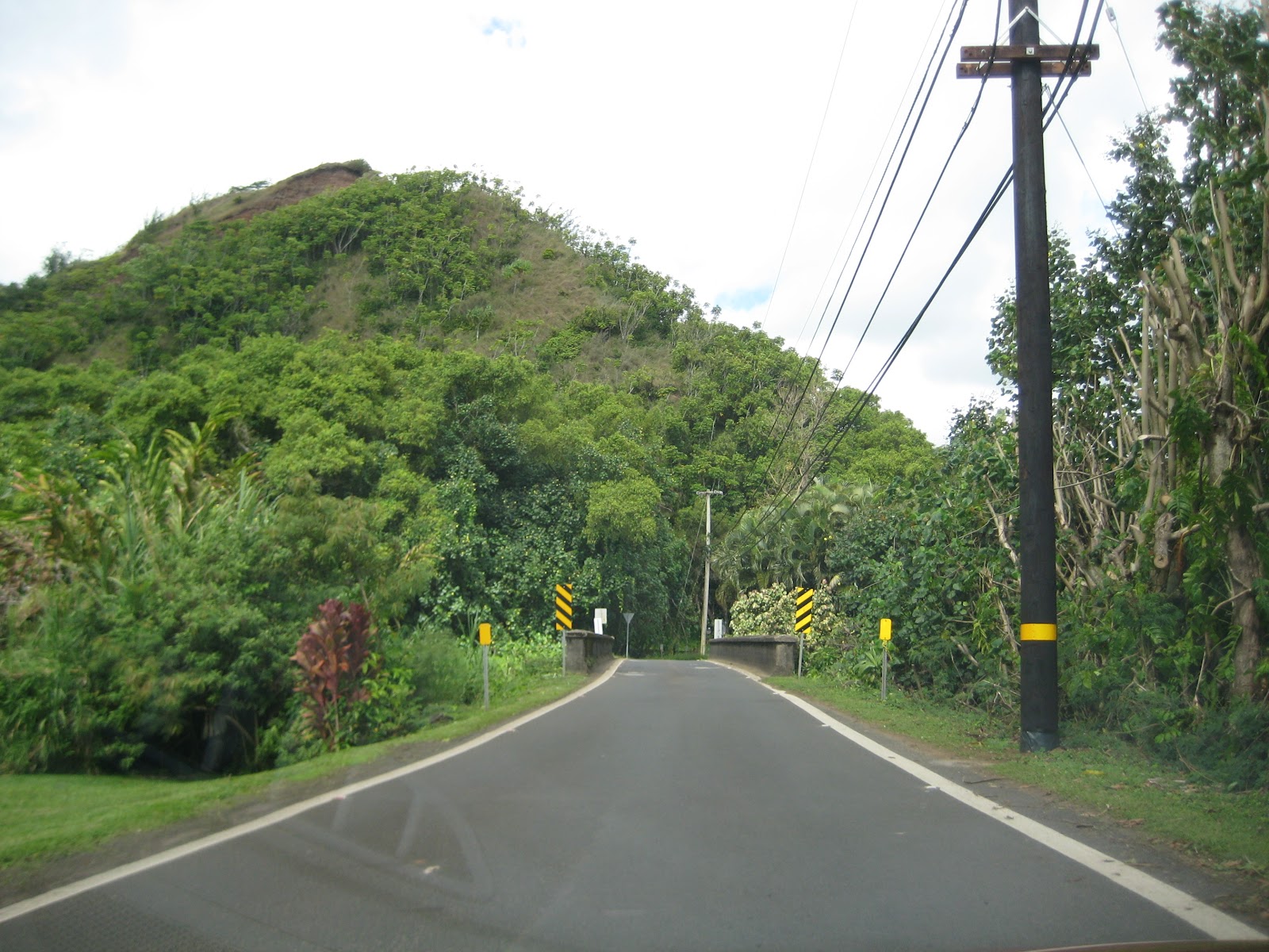
After Princeville, the road turns into a "scenic drive", officially Route 560 (and also still part of the Kuhio Highway (Rt. 56) that nearly circumnavigates the island) sprinkled with one-lane bridges, narrow stretches with cars parked on both sides, dotted with pedestrians and cyclists, and more chickens.


When we finally reached the end, at Ke'e beach and/or Haʻena State Park, there was nowhere to park, so we backtracked about 3/4 of a mile, ditched the rental car on the side of the road, and walked back to the end of the road, as is apparently the custom. (Photo is not our car. You think Sabrina would let me park illegally? Ha!)

We stashed our stuff amongst the rocks and headed in for some barely-underwater exploration. Sabrina had some technical difficulties with her mask, but I was able to upgrade Snorkel Bob's finest equipment from "leaky" to "passable" via judicious application of duct tape. Never again will I be criticized for always traveling with a roll of duct tape (and a flashlight).


I managed to take dozens of photos (and videos, some of which were intentionally video, none of which were intentionally slow-mo) of fish, coral, my flippers, other people, Sabrina, a seal, an upside-down lobster, etc.; operation of the iPhone touchscreen underwater is tricky, especially when trying to follow a fish while being jostled by waves. Yes, I take my phone in the ocean. Don't you? Lifeproof™ case FTW.


The water appears very green, or very clear, depending on the amount of cloud blocking the sun and the whim of the whitepoint calculation in the iPhone.


Having exhausted the snorkeling opportunities (and my phone's battery), we packed up and headed back to the car; Ke'e beach was actually quite crowded, despite being at the literal end of the island, so we decided to backtrack slightly to the park entrance and Ha'ena beach proper.


We relaxed on the beach for... I have no idea how long... an hour? Maybe two?
It rain-showered very briefly, as it has done sporadically since we got here, but we are always prepared.

Oh, and there's a cave (so-called "dry cave", in contrast to the one filled with water by Ke'e beach) that was large but had nothing in it. (Always travel with a flashlight!)


Does anyone know what the hell this is? I've seen them all around the island.

It was around 4 PM when we began the return trip. We discussed options for things to stop and see on the way back. There's allegedly a lighthouse north of Kilauea, but the internets told us it closed at 4. We tabled this option until further notice.
The option we chose to exercise was stopping at the .Hanalei Pier. The weather inland looked threatening, although the beach was busy. It started to rain again, so we retreated to the car and continued along the coast.


Our last stop was yet another beach (it's just beaches and beaches, eveywhere) for a quick look around. The rock suggests it was Kealia Beach, which is enough evidence for me.


When we got back to the condo, we took a quick rinse in the pool (more like a hot tub, at 94° F) before unpacking and heading out again for dinner. Someone was grilling next to the pool, which put me on the hunt for something with teriyaki sauce. We ended up at Bubba's, where my craving was satisfied. Sabrina had a taro (veggie) burger. She seemed slightly underwhelmed by it.
Tomorrow, if we've correctly reckoned which day it is, should involve some kayaking, a river, possibly some hiking, and possibly some waterfall. Stay tuned.
P.S. Why does Google Photos think the videos from the iPhone are from the future? It keeps dating them as today+1. Inquiring minds need to know.
3 comments:
I❤️YourEDC: duct tape and a flashlight.
Hike up to a waterfall. See puff the magic dragon in the tree lines. You can do it. ;-)
"Does anyone know what the hell this is? I've seen them all around the island."
Tsunami warning siren.
That's, uh... comforting? I sort of suspected that, but it seemed like there were too many of them...
Post a Comment