The days start early, here on the farm.
This morning, our alarm was a tractor pulling a mowing attachment, just after 7 AM. I took a short video from the porch, so we can relive that sound at some future date.
We had breakfast on the patio, as the tractor did laps in the adjacent field.

He was still going strong at 9:30, as we were starting to pack the car and discussing plans for the day.

(I had expectations of being woken up tomorrow morning by the hay baler, tractor loading bales, etc., but they baled and carted off the evidence while we were out for the day.)
The field looked good, with the hay in neat lines, as we left the farm around 10:30 AM.

It was a perfect day for more hiking: partly cloudy, high of 84F, and a gentle breeze.
We gassed up and drove about 45 minutes back up to Thornton Gap, entered the park, and headed north on Skyline Drive.
Our first hike today was the Overall Run Falls trail.
Sabrina spent the first half mile yelling at bugs, and attempting to sword-fight them with her hiking poles. Eventually she relented, and applied bug spray, as you can see in this action shot.

The trail was mostly downhill-but-gradual, until we reached the upper falls. The path down to the water was precarious.


We found some flat-ish rocks in the shade, and enjoyed our lunch amidst the cool rock walls of the small valley at the base of the waterfall.

Here you can see me using the behind-the-head selfie technique. Judging by my eyes, I'm not cut out for farm life.

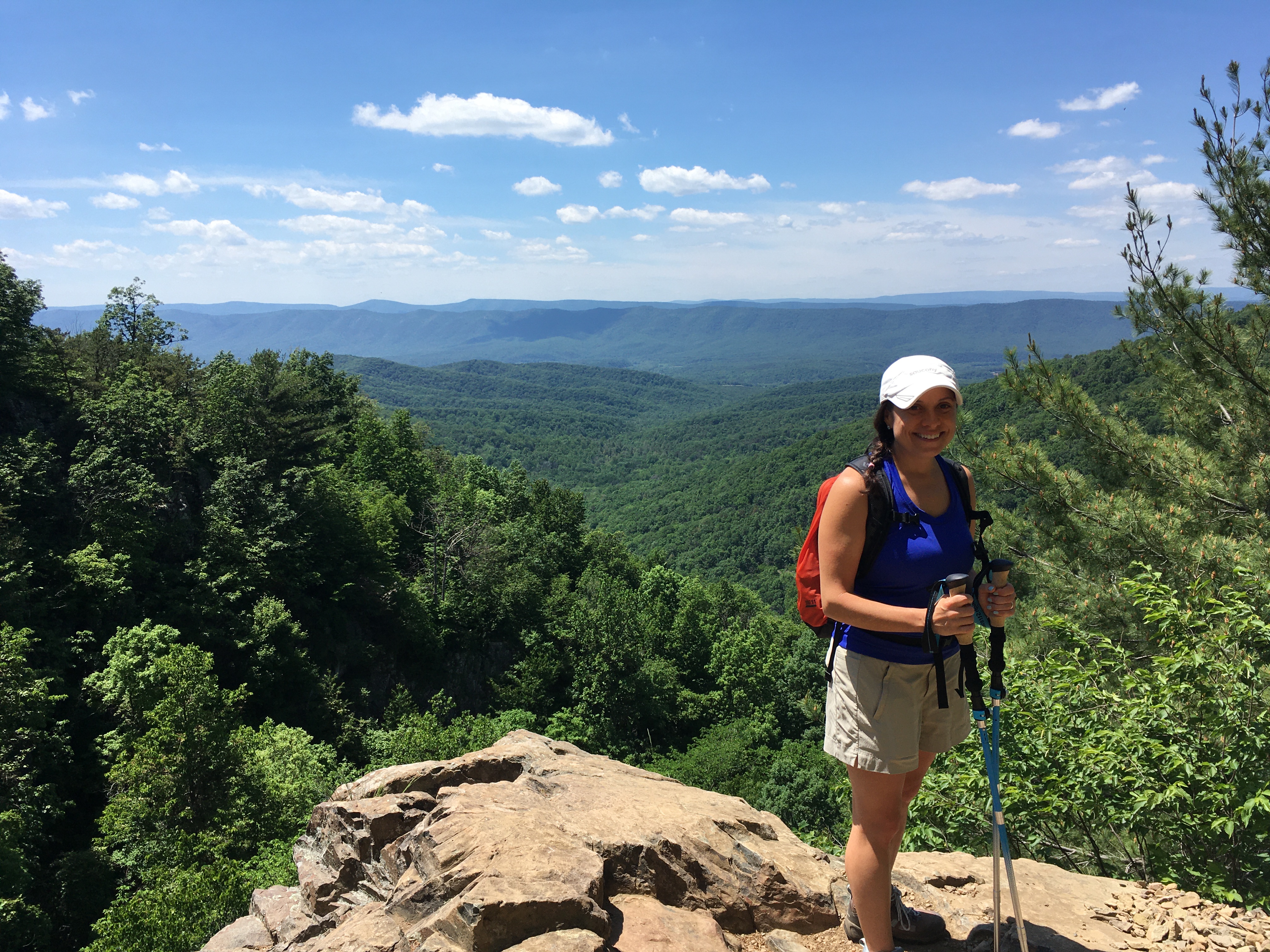
As you can see, we wanted to blend in with the serious backpackers today, and therefore went with the wool socks and boots. (Also it wasn't as hot, and we probably should have used the boots on Tuesday, too.)


After lunch, we continued down the trail, which got increasingly ridiculous, until we found the viewing platform for the lower falls.

Overall Run Falls, the top of which is barely visible here, is the highest waterfall in the park, at 93 feet.

The view of the Shenandoah valley was also spectacular, although difficult to capture without getting too close to the edge.
Here's the best shot I could get of the falls, without risking a lethal tumble.

The edge of this rock leans out over a sheer drop of hundreds of feet.


After admiring the view for a while, we opted not to do the additional 1.5 miles to the bottom of the falls, and headed back uphill towards the parking lot. We did, however, opt to return via a different path, making it into a loop of about 5¼ miles.

We continued north along Skyline Drive, and eventually stopped at an overlook for a snack break and more planning.


We were going to just sit on the rock wall, but it was covered with tiny red ants. Thankfully, we had two camping chairs in the car for just such an emergency.

I didn't want to sit in the sun, so I turned the car around for some shade, and we enjoyed more leftover chips/salsa with some fresh guacamole, just as we had done on Tuesday.
The view was splendid, and there was a cool breeze flowing up the hillside.

We decided to squeeze in one more short hike, on the way towards the northern park entrance.
Along the way, we stopped to admire the view and caught a glint of sunlight reflecting off the Shenandoah River.

For our second, easier hike today, we parked at the Dickey Ridge Visitor Center, heading for the Fox Hollow Trail.
It was around this point that we suddenly had cell phone reception, for the first time in about 5 hours.
Sabrina had received a series of messages from our Airbnb host, detailing some problem with the (water) well pump back at the farm, explaining that they were working on alternative accommodations and/or water supply for us. We told them we'd like a place to shower, but other than that would just roll with whatever happened.
What that settled, we commenced our short hike through the site of a former homestead, complete with random rock piles/walls and a (still-maintained) cemetery.

We were once again on the lee side of the ridge, though, so the air was still and humid. The trail was fairly easy, but we still had over an hour's drive back to the house. We had considered extending this second hike along another route, but opted out and returned to the car after about 45 minutes.

After changing into flip flops and less-sweaty clothes, we received an update about the water situation; it was just a broken pressure switch, and had been resolved already. They seemed surprised that we were unconcerned about the threat of surviving one night without running water.
The view from the visitors center was completed by this inviting bench, but we didn't have any more time to sit around today.

On the drive back to the farm, we ordered takeout from Mad Local, in Madison; this proved to be unfamiliarly difficult due to poor cell coverage.
They seemed to feature their local, organic chicken sandwiches, so we both got chicken. It was very good, which was fortunate because they seemed to be just about the only place that was open.
This is not an area for a food-focused trip, it seems.
As usual, we ate on the patio as the sun set (behind the storm clouds, again).

The weather forecast looks iffy, in the afternoon. I'll report back when I know more.
No comments:
Post a Comment