We were up early today, and out of the house before 9 AM, to ensure we could catch the 10 AM ferry to
St. John. It takes over half an hour to get across the island, a total distance of 12 miles from our rental, to the port at
Red Hook.
Calling it a ferry could be considered generous, which might be why they refer to it as a "car barge".
The disinterested car wranglers lined us up in rows, facing away from the barge, and then directed everyone to back up the ramp one at a time.
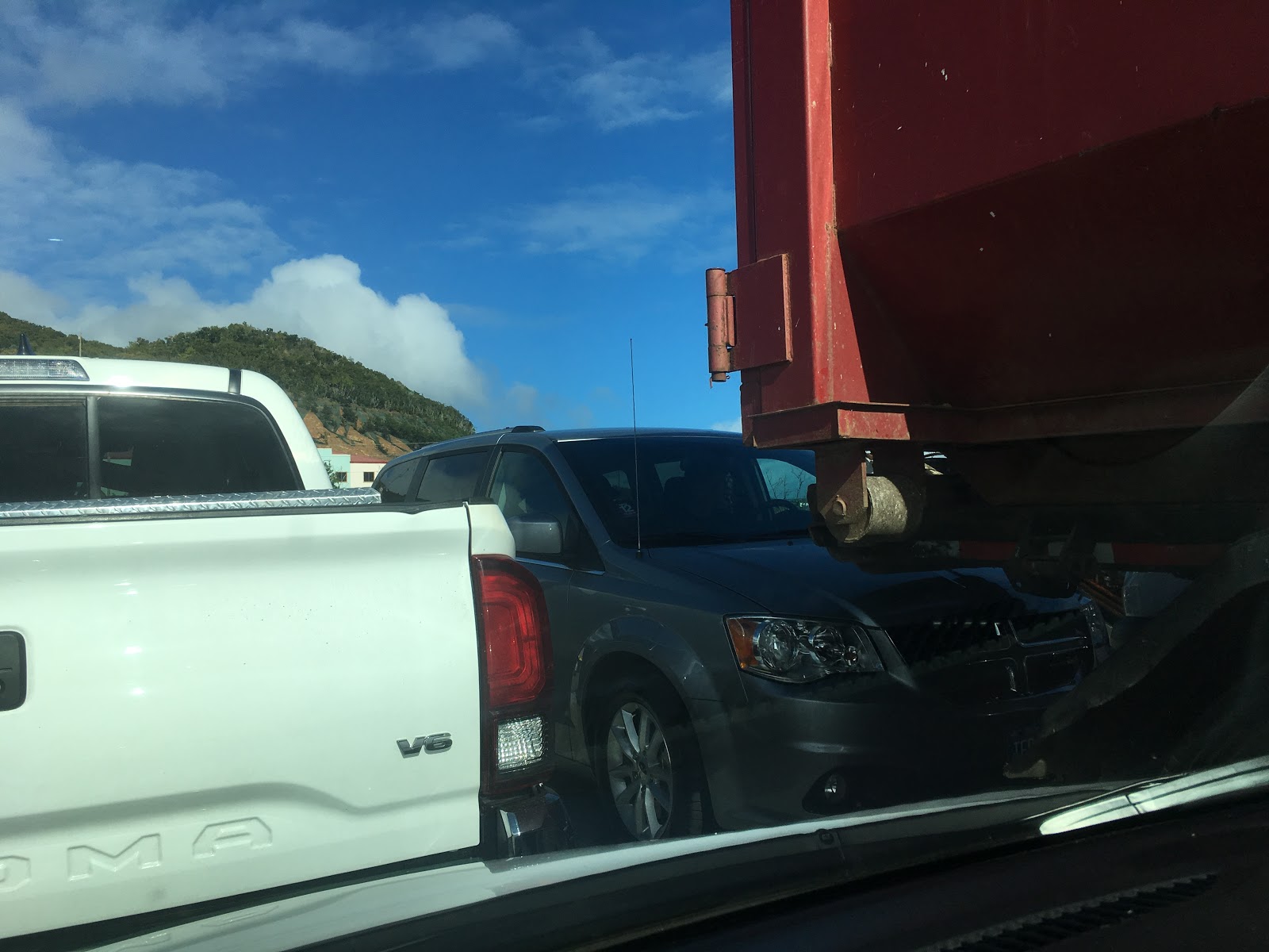
Due to the "car barge" being the only way to get vehicles to/from St. John, it's also used to transport trucks of all sorts. They get loaded in the middle, understandably, but it makes for a tight fit.
The passenger ferry looked luxurious by comparison, from my vantage point sitting through the open window of the car door.
There are two different car barges, operated by different companies who don't accept each others' tickets. The one we took this morning happened to be the one with a nice seating area up top, which we didn't notice until much too late. I would have had to climb out the window, anyway, and I'm not sure the doors on the other side would have opened enough to get out either.
Once we arrived in
Cruz Bay (okay, technically it was
Enighed), it was a mad dash to get off the barge, reminiscent of the merge lanes after a wide toll booth plaza.
We had originally planned to stop somewhere in town for a quick brunch, but the small town was a chaotic mess with several closed roads, flocks of wandering pedestrians, and nary a single available patch of unoccupied space to jam a Nissan.
We passed through without fanfare, and headed for the scenic drive along the coast, through the
Virgin Islands National Park, stopping at every available overlook.
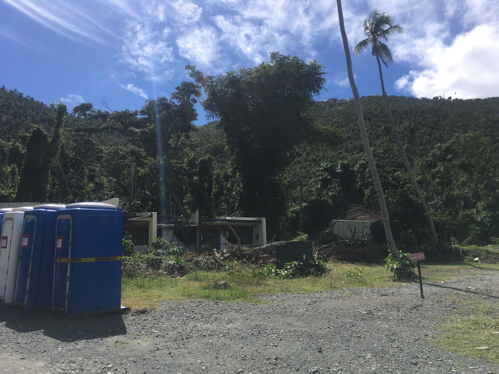
Some of the beach areas are still closed due to extensive hurricane damage from 2017 (
Irma and
Maria). I think this was the entrance to the Honeymoon Bay area.
Some of the beaches that are open still have no facilities, because they haven't been rebuilt since the hurricanes. And even if they had, they would be closed due to the government shutdown (thanks, Trump).
We stopped at Hawksnest beach just to look around, but weren't ready to commit to a swim yet.
Not too far past that beach, we hiked up to
Peace Hill to see the ruins of a windmill.
The hill also afforded lovely views of the bays on either side.
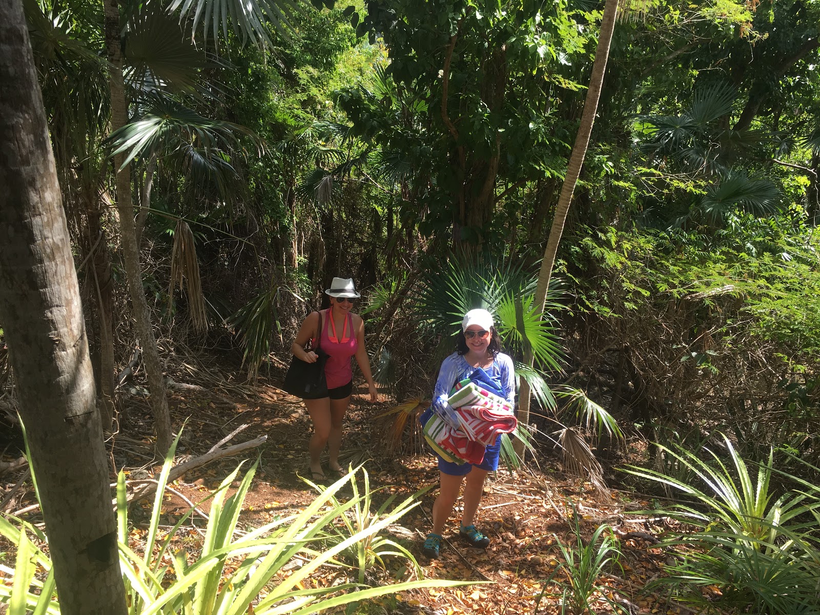
On the way back to the small parking lot, we took a side trail all the way down to the water, to a secluded beach on
Denis Bay.
The beach was devoid of guests, but the surf was rough and we still weren't prepared to go in the water, so we admired the view and walked around a bit before hiking back up to the road.
Just down the road from the Peace Hill trail, there was a beautiful view of Trunk Bay.
In addition to being (relatively) crowded, it was also lacking intact structures and available parking, so we didn't partake.
We did stop, however, at Cinnamon Bay. The casual passer-by could be forgiven for believing the parking lot was hosting a jeep jamboree, as that seems to be all that people rent on this island.
Outdated information led us to believe we would be able to get lunch at Cinnamon Bay, but this was one of the locations that was open-yet-wrecked.
The beach, however, was beautiful enough to convince us to stay for over an hour.
It wasn't crowded, but there were a few dozen other people around. I try to avoid taking photos of random strangers at the beach, though. I assume they appreciate it.
Next up: another overlook. This is Maho Bay and Francis Bay, according to Google Maps.
The next scenic spot was a view of
Coral Bay, which resembled civilization enough, from this vantage point, that we hoped to finally get some lunch once we made it down there.
On the way down the hill into town, there was a sign that read "Donkeys All Day And Night". It wasn't in an area where I could stop for a photo, sadly. We didn't think much of it, at the time.
We lunched at the first place we came across:
Pickles in Paradise. It happened to be a good choice.
The parking lot and... let's call it a patio area... offered some encounters with the resident wildlife, as an added bonus.
After lunch, we headed south along the coast, vaguely aiming for
Salt Pond Bay.
This side of the island is a bit of a desert, but it still seemed strange to us to find such a variety of cacti on a tropical island.
The beach was peaceful and beautiful. As was becoming the norm, it was also lacking any intact structures or facilities, except for a single (closed) bathroom.
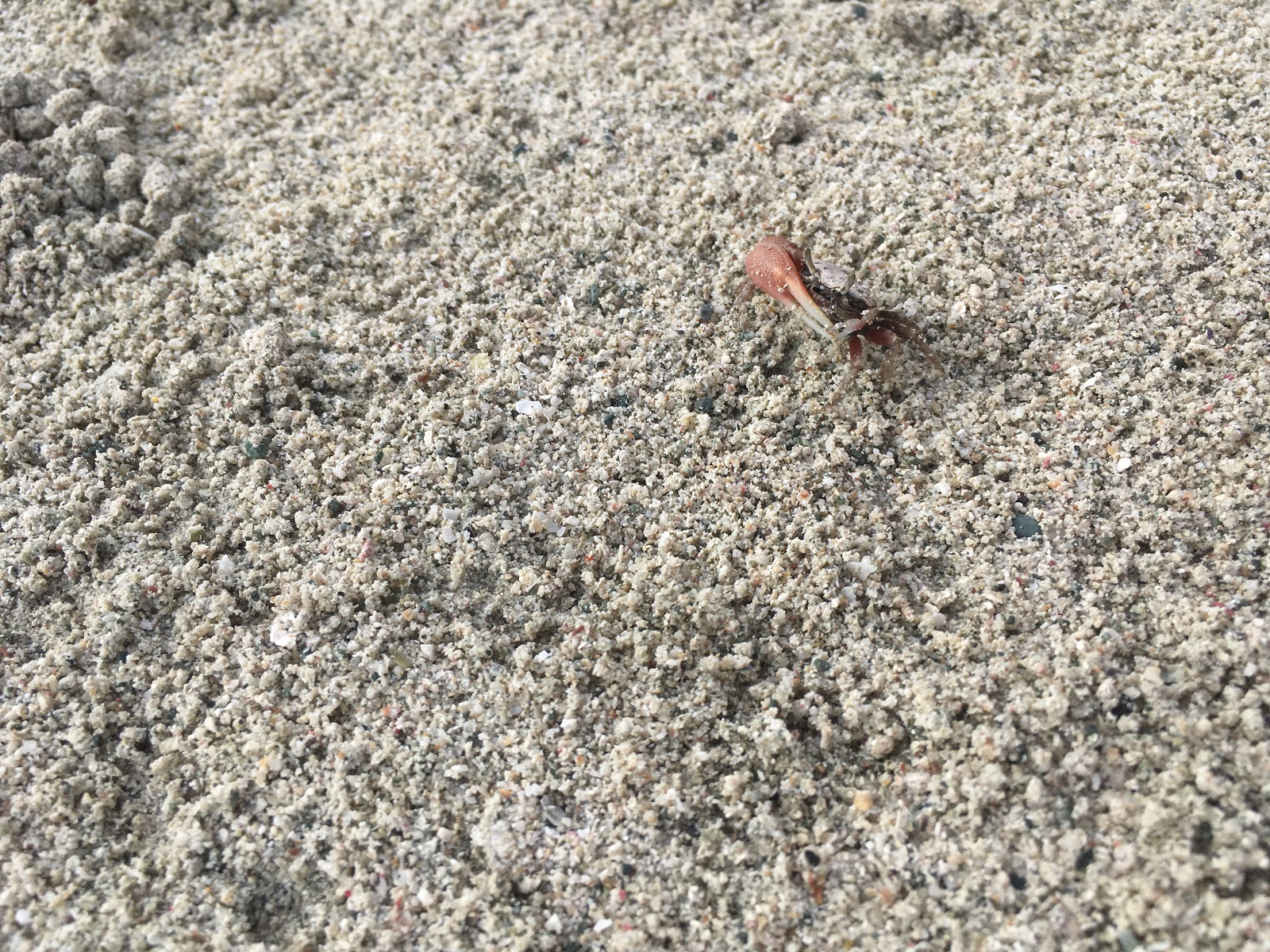
Sabrina and I ventured over to the salt pond while Lauren caught up on some reading. A woman coming down the path informed us about the shocking "orange" body of water she had just discovered, and, after asking if we were locals, implored us to go witness it in person. She wanted to know how I knew it was "the salt pond". It was an odd exchange.
The shore around the salt pond was filled with tiny
fiddler crabs, some of whom were ready to fight my iPhone.
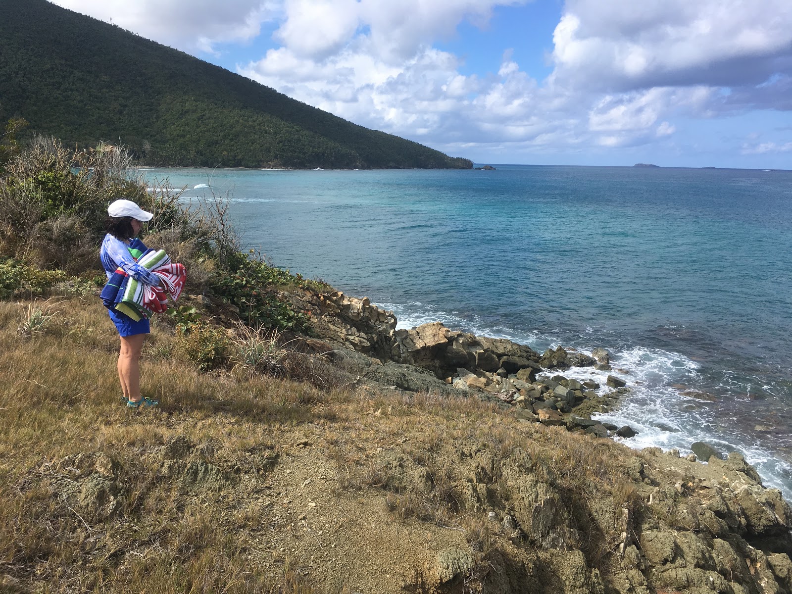
We flirted briefly with the trail to
Ram's Head, but called it quits less than halfway to the end, in sight of the Ram's Head crest.
Upon returning to the beach, we rinsed off in the crystal-clear water and lounged about until the sun started threatening descent.
On the drive back to the west side of the island, there were donkeys in the road, all over the place. Also it was raining lightly. I'm not sure if these two things are truly related, but they did correlate and we didn't see a single donkey on the outbound trip. You be the judge.
After narrowly beating the bulk of the rain back to Cruz Bay, we again backed onto a car barge (the other one, this time) and took the 6:15 sunset cruise back to St. Thomas.
Side note: It took this tow truck driver two attempts, but he managed to back a Coca Cola delivery truck onto the barge. Cheap entertainment, for sure.
This time, we not only knew that there was a "passenger lounge" (bit of a stretch), but were also able to open the car doors, so we had a better view for this passage.
It was approaching 7 PM when we disembarked the car barge, so we opted to eat on the east end of the island before returning to the rental.
After evaluating half a dozen options, we settled on a pizza venue between Red Hook and Lindquist Beach.
This decision came with the added bonus of allowing time for the roads to dry off, at least partially, before our nighttime Nissan rollercoaster ride back to the rental house.
Tomorrow, we plan to sleep in, eat a big breakfast, and have a relaxing day closer to our home base.