Our flight wasn't until 3:05 PM and checkout wasn't until 12, so we had a relaxing morning at the villa, interspersed with some packing and organizing.
This is the first thing I saw out the window, after exiting the bedroom this morning: Steve helping Jeanne get some clothes off the line, because it was seven feet above the ground for some reason.

I had some breakfast and retreated to one of the porches to read a book. An hour or so later, I found everyone lounging around the pool, variously enjoying the sun or a slice of shade.

It was a beautiful 80F with a strong breeze and scattered, thin clouds; we were all ready to stay another day, but it was time to load up the van one last time and head back to the aiport.


Just before 12 noon, our host arrived to say goodbye, collect the keys, and chat about our visit. He was not surprised to hear about the tarantula, answering "Oh yes, we have them in the garden. They come out when it rains, because their burrows fill up with water."
We thanked him again for their patience with our delayed arrival, for leaving water, beer, wine, and fresh fruit for us, and for their wonderful hospitality.
It was only about a 15-minute drive to the rental car return area, straight up and over the hill between the house and there. The bottom of the rear bumper cover scraped on the way out of the steep driveway one last time (for probably the ninth or tenth time in 6 days); we hoped they wouldn't notice (or care about) the slight sag, when we returned it.


As with everything else on the island, returning the rental car took 15 minutes longer than it should have (#islandtime).
The airport was somehow quite confusing, considering that it's not very large. (I think there were maybe ten gates?) The rental car area is past the arrivals area (maybe for obvious reasons) so we had to walk the entire length of the atrium/lobby.

The signs pointed us up an escalator for "check-in", but that was where the emigration checkpoint and security screening areas were; to check in, we had to go back down (stairs), down to the far end of the lobby, around the corner to the United counters.
I'd hoped we could just have two people bring six passports, since we'd already checked in online, but they insisted on seeing everyone in person. After dragging all our bags down there and persuading their security personnel that we had our passports, we were able to get boarding passes and then go back upstairs to wait in several lines.

Despite passport control and security also being on island time, we made it through with time for a quick look around the small airport before boarding. There wasn't really time to eat anything, especially given the lengthy line at the only real food venue, so we went right to the gate. I'm not really sure what everyone else was doing, as I got selected for additional security screening and paged to the counter; it was rather casual, as far as these things go (not my first SSSS designation).
At 2:40 PM, we emerged into the savage sun one last time to hoof it out the to plane. At least boarding goes faster when using both front and rear doors.


The flight was unremarkable, and even felt quick compared to our southbound debacle. Most of us enjoyed some quality time with our books, and it was all over before we knew it.


We hustled off the aircraft ASAP, and marched (what felt like half a mile) straight to immigration where we found literally no line whatsoever, for once. From there, it was a short walk to a cramped Uber XL back to Lauren's building, where we had a late dinner before carpooling everyone home.
Overall, it was a rather frictionless, uneventful travel day, which is all we can ask for.
Antigua had a similar feel as the USVI, or a little bit like St. Lucia (although that's hard to judge, as we were there during COVID restrictions) but with less dramatic/mountainous terrain. The shape of the island made it easier to explore than Tortola, where we were last year.
It rained a little bit almost every evening or morning, but it didn't affect us at all. I definitely wouldn't want to be there during a serious storm or hurricane, as the flooding must be severe.
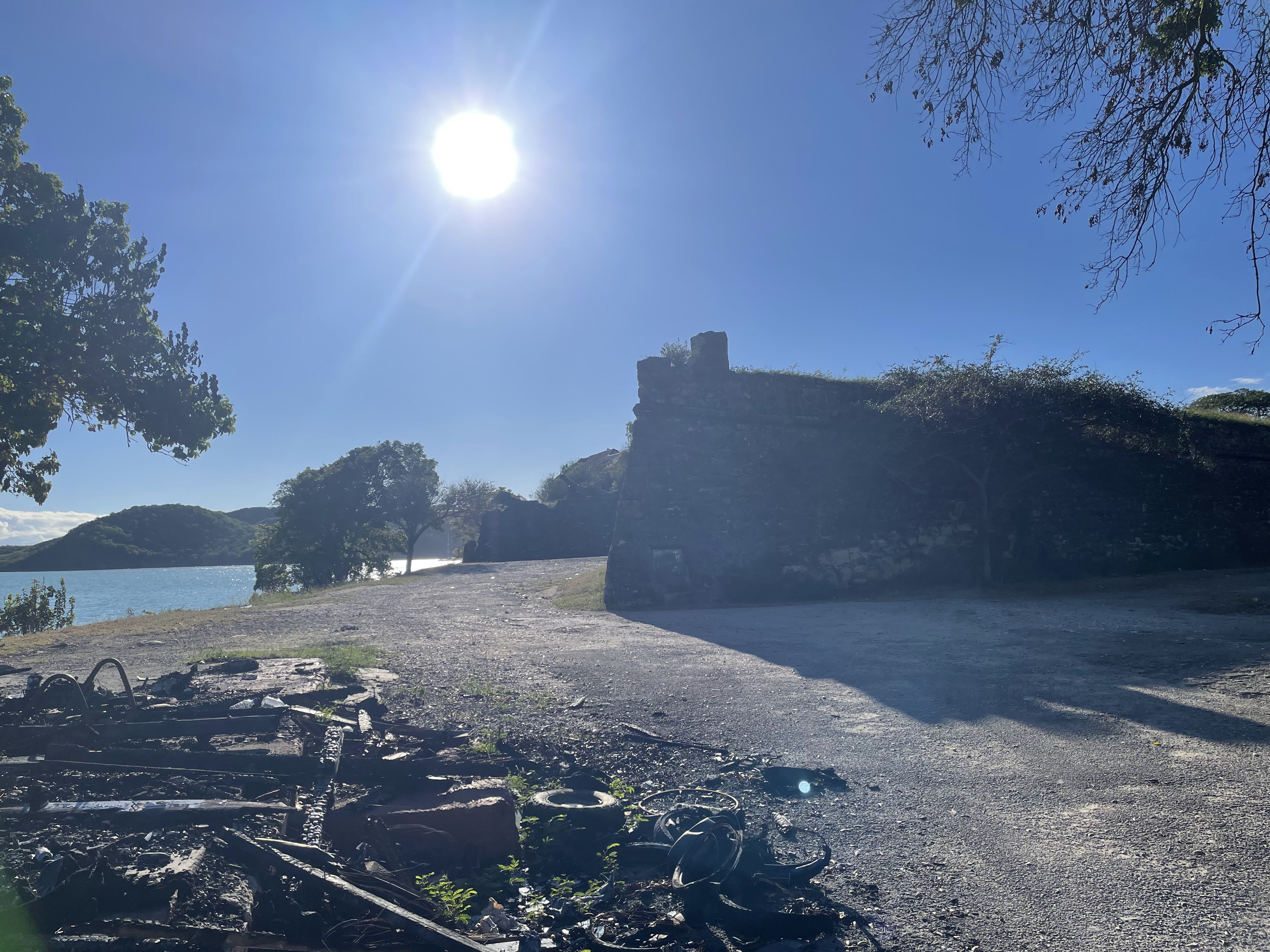
The food, people, and culture were all wonderful, and I like that there's some history to experience beyond the beaches (there are more than 100 sugar mill towers around the island, for example). It's certainly not an easy place to explore, and has little-to-no public transit whatsoever (we saw a few buses, but they didn't seem to have extensive coverage).
Other than Sandals, we didn't see any large resort brands that I recognized; they seemed to be mostly independent/boutique (or maybe just British/European?). There were no huge resort/casino complexes on the beach, as in some other places we've been.
In no particular order, here are some things that I'd want to know if I were to go back to Antigua:
- Driving
- Google Maps cannot be fully trusted; several times, it tried to send us down unimproved/dirt/gravel roads that we weren't even sure were roads, or hallucinated roads that were not there at all.
- The roads are generally terrible, just like everywhere else in the Caribbean we've been, although the road along the southwestern coast wasn't awful.
- I've driven many rental cars, but this is the first time an employee has ever specifically shown me the location of the jack and tools for changing a tire, the implications of which were slightly troubling. (We did see only one tourist with a flat tire, though.)
- There are many, many speedbumps, usually in pairs, sometimes with warning signs but usually not.
- There's a temporary driving permit that costs $20 US (cash only) at the rental counter.
- Airport
- When departing, don't go upstairs without a boarding pass.
- For departure, 2 hours early was enough time, but 2.5 would've been better during busy Christmas travel.
- The rental car companies literally share one giant counter in the same building; they are functionally equivalent, and all offer slow/mediocre service (sample size of one, around Christmas).
- There was no wifi available in the airport, and the cell signal was so weak my Solis hotspot didn't work.
- I find the $55 VIP service to be offensive, but I would've gladly paid it had I known how unprepared they'd be for holiday travel volume at immigration. It appears to require advanced planning.
- Money
- The internet suggests the official abbreviation for the Eastern Caribbean Dollar is XCD, but they use ECD everywhere I saw in Antigua (and St. Lucia).
- The fancier restaurants insist on charging your card in USD, despite listing all prices in ECD; they will not give you the true exchange rate (2.7:1), instead using 2.6 (or 2.65), which seems shady and lets them pocket the difference (theoretically, the bank/card-issuer gives a better rate). This seems trivial but can add up to actual money on a large restaurant bill.
- Similarly, prices at beach bars or restaurants will be a better deal in ECD but not significant enough to merit carrying ECD (e.g. a beer might be $12 EC / $5 US).
- We didn't need or use any ECD cash, but US cash is accepted everywhere, and seemed expected for chair/umbrella/whatever rental.
- Every restaurant included a 10% service charge (one was 12.5%) automatically, but an extra 5% or so in US cash for great service seemed to be the norm at the higher-end restaurants.
- We had a waitress refuse a $20 because it had a tiny tear in it, stating that the bank wouldn't accept it (we supplied a pristine $20 instead).
- Sights/Activities
- There are beaches everywhere, but the east coast is probably not great for swimming.
- There always seemed to be some public access/parking, at least at the five or six beaches we visited. If not, there are plenty of other options.
- Downtown St. John's is not a great place to visit, mostly because the roads are narrow and disjointed, but also because there isn't much reason to go there.
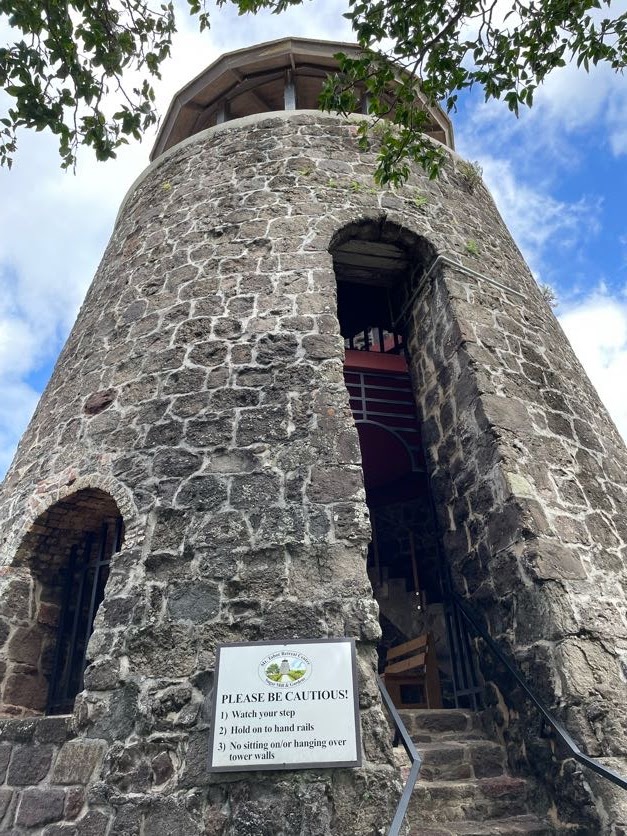
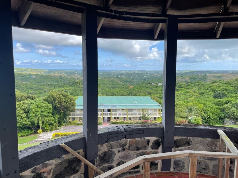
- The tea house is worth the drive.
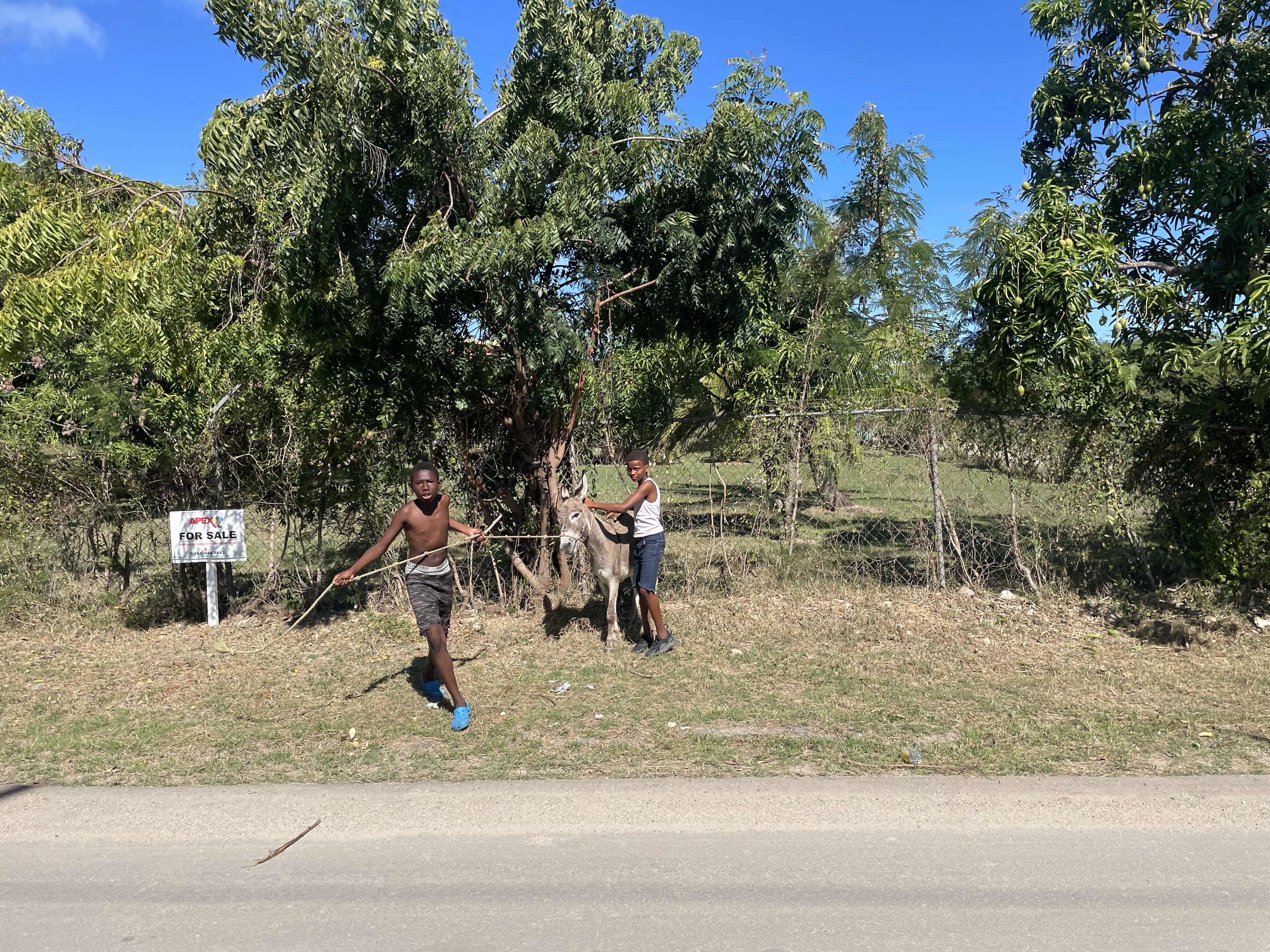
- Stop at a roadside fruit vendor.
- Consider Stingray City 😉
- Consider CocoVibes for charter boat, for not much more money than a large group tour.
- There's apparently a huge party at Shirley Heights on Sunday evenings.
- Cruise ship schedules need to be taken into consideration.
- Boxing Day is a real holiday, and things are closed.
- I feel it was worth the $20 EC to get into Nelson's Dockyard (I see people on forums saying they paid much more, but that it also included admission to two or three other historic attractions).
- Misc
- There were US outlets/plugs, at least where we stayed. They might've been 120V or 240V, unclear.
- We saw several RO plants along the coast, and it looks like there's municipal water available many places, but restaurants all served bottled water.
- The villa's tap water was perfectly fine, seemed to be rain-capture/cistern and filtered on-site.
- The Epicurian grocery store was wonderful; First Choice was good but less fancy.
- We saw maybe two or three people riding bicycles on insane roads (aside from a few at one beach area)... I would never consider doing that, there.